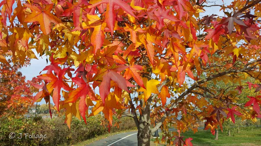
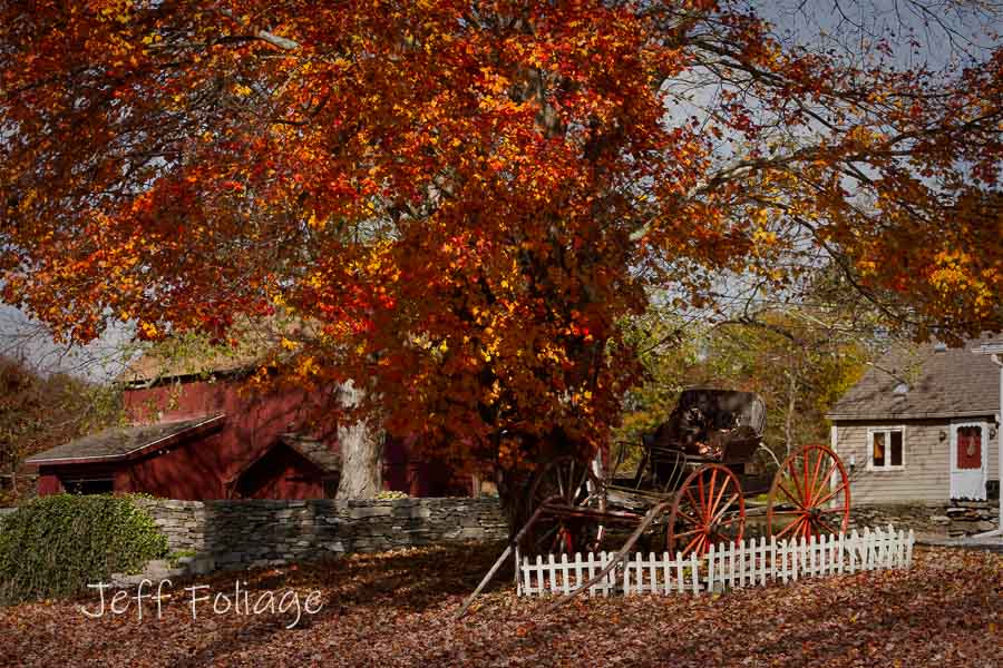
Fall in Rhode Island & Connecticut
Many folks are asking where we go in RI and CT.
Well, this one is a no-brainer! I’ve been telling you to plan your visit around events and places you want to visit. Then on your way to and from them, you can search for the fall colors. If you come just for the colors and not a slice of fresh apple or pumpkin pie and some hot apple cider then you could be disappointed by what the year provides us.
If you are arriving in New England later in the season (like the middle to the end of October), then southern Massachusetts, Connecticut, and Rhode Island are the areas you want to focus on. Many people think that fall foliage season is over by then, but there is still plenty of foliage to enjoy.
Granted, these areas do not have to majestic mountains of northern New Hampshire and Vermont that give you those sweeping views. Also, there are fewer maples than up north which give those fiery reds (some years). However, that is not to say there aren’t beautiful colors to enjoy. There are still lots of maples, and there are also ALOT of other trees that provide rainbow colors.

Also, the later in October you come, the more Halloween-themed fun you will be able to find! One of our favorites, besides Salem Massachusetts, that is, is the Roger Williams Zoo with its Jack-O-Lantern Spectacular in Providence, Rhode Island, which will sure to entertain and amaze.
But if Halloween isn’t your thing and/or you want to get out and do some hiking, here is a list of some places in Connecticut that might give you some great foliage views. I am sure the drive to these parks and forests will be beautiful.
Here are just a few of Connecticut’s best scenic viewing areas:
- Macedonia Brook State Park –– Kent – Cobble Mountain From Kent Center, take Route 341 west for approximately 2 miles. Take first right onto Macedonia Brook Road, which takes you into the park. (Bear left at the fork.) The office and parking lot are located 1 mile inside the park. Trail maps are available. Take the white-blazed Cobble Mountain Trail. The overlook has views across the Harlem Valley to the Taconic and Catskill Mountains.
- Mohawk State Forest — Cornwall From Torrington take Route 4W (14 miles) to the forest entrance (Toumey Road) on left. Take the road to the ‘T’ intersection and turn right onto Mohawk Mountain Road. Scenic vistas to the north and west include the Catskill, Taconic, and Berkshire ranges. For your hiking pleasure, both the Mattatuck and Mohawk trails (blue-blazed) cross the site.
- Pachaug State Forest — Voluntown – Mt. Misery Overlook From Voluntown take Route 49N (6 miles) to the forest entrance on the left. Go west (2 miles) and bear left at forks to the parking area. Take the woods access road on left to overlook. This forest also contains miles of roads and hiking trails.
- Peoples State Forest — Barkhamsted – Chaugnam Lookout From the junction of Routes 318 and 181 in Pleasant Valley, go east over the bridge then take the first left onto East River Road. Jesse Gerard trailhead is 2.4 miles on the right. The recreation area is opposite the trailhead. Take a trail (yellow blazes) to two lookouts.
- Shenipsit State Forest — Somers – Observation Tower From Somers, take Route 190E (1.25 miles) to the blinking yellow light. Turn right onto Gulf Road (2.25 miles) to next right after Mountain View Road, which is Soapstone Mountain Road. Take the road to the tower parking lot. For your hiking enjoyment, Shenipsit Trail (blue-blazed) runs by the tower. The observation tower on Soapstone Mountain provides wonderful views of the surrounding and distant landscapes.
- Sleeping Giant State Park — Hamden – Stone Tower From Hamden, take Route 10N (2 miles) to Mount Carmel Avenue. Turn right, the main entrance and parking are located approximately .25 miles on the left. From the entrance lot, take a gravel path (1.5 miles) to Stone Tower. From the tower, you have a 360-degree panorama looking south to Long Island and north past Hartford. For additional hiking, Sleeping Giant has 30 miles of trails that form the giant’s head’ to his ‘left knee’ and ‘right foot.’ The park also has an extensive trail system for all levels of hiking ability.
- Talcott Mountain State Park — Simsbury – Heublein Tower From Bloomfield, take Route 185W (3 miles) to the entrance sign on the left after the mountain crest. Park along the road near the trailhead. Hike to the ridge, then left to the restored Heublein tower. View from the tower is over the Farmington River Valley. Another nearby alternative is located at Penwood State Park (entrance is on the left 500 feet east of Talcott Mountain entrance). From the parking lot, a hike up the gated road loops to an escarpment overlook.
- Mt. Tom State Park — Litchfield – Stone Tower Located off Route 2021. The tower is 325 feet above sea level and can be reached by hiking a one-mile-long trail.
- Dennis Hill State Park — Norfolk – A summit pavilion Located off Route 272. The pavilion is 1, 627 feet above sea level and provides views of New Hampshire, Vermont’s Green Mountains, and more. The drive to the summit is open on weekends only from October 4 through October 26.
- James L. Goodwin State Park and Conservation Area — Hampton — Off Route 6 at 23 Potter Road. View autumn colors reflected in the water of Pine Acres Lake from the wildlife-watching platform (wheelchair accessible). You can also walk through the canopy along one section of the Air Line Trail in the Goodwin State Forest.
Driving suggestions for Rhode Island
I’m pulling a couple of driving tours from Yankee Magazine. I would read these over, and then pull out your map book and see what is interesting in these areas.
Leaves, Views, and Other Surprises in Little Rhody
A Recommended Drive: Rhode Island

Rhode Island Byways
Here are some routes in Rhode Island that you might find interesting.
- Shannock Road: The roadway winds through a unique area of rolling terrain and a variety of different landscapes including marshes, woodlands, and farm fields bounded by stone walls. Midway along the road is the historic Shannock Village, a small, but well-preserved, rural textile mill village.
- Ministerial Road: The roadway, designated as Route 110, passes through dense stands of upland forest well known for the extensive areas of mountain laurel and rhododendron, which grow underneath the upland forest canopy. The road passes through a rolling landscape characterized by glacial kettle holes and moraines, several small brooks, wetlands, and Larkin Pond.
- Paradise Avenue: An 8.3-mile scenic roadway network along Paradise Avenue, Berkeley Avenue, Wyatt Road, Mitchell’s Lane, Wapping Road, Peckham Avenue, Indian Avenue, and Hanging Rock Road. Contained within the boundaries of the scenic road network are many locally significant historic features, both manmade and natural, as well as some of the national interest. The entire area is filled with historic homes of all types of architectural styles from Victorian to Greek Revival and to colonial as well as other 18th Century structures.
- Great Road/Breakneck Hill Road: 1.4 miles along Route 123 from Route 146 to Manchester Print Works Road. This scenic roadway is known for great vistas at every curve and bends along its path across the Moshassuck River Valley. It traverses vast open space and rolling farmlands, punctuated by the view of a towering sycamore amidst open fields and fir trees.
- Route 102: Route 102 actually stretches from near the Massachusetts border down to North Kingston. Some of this roadway traverses Exeter’s rolling topography, with elongated hills that run north to south, separated by narrow valleys. These hills are some of the highest in Rhode Island, up to 560 feet above sea level. The landscape of woodland pastures is unspoiled by commercial development. Commonly known as “Exeter’s Main Street,” Route 102 was once used to carry goods and livestock to a market at the colonial seaport of Wickford.
You can find more such scenic byways by visiting this DOT Rhode Island webpage. But these suggestions should help you plan your trip as I put them down, I feel a road trip is needed to go check them out…
Jeff Foliage Folger
Autumn is a state of mind more than a time of year – Jeff Foliage
- Visit my Fine Art America Gallery
- Visit my Amazon store to pick up New England-related materials
- Visit my Pictorem Gallery (Free shipping in the US and Canada)
- My Facebook foliage page
- Threads.net/@Jeff_Foliage
- Follow our new Fall Foliage FB Group!
- You can visit Lisa’s Artist Facebook Page by clicking here


Hi Jeff. Was in Stonington on Sunday…(unfortunately the occasion prevented my from taking photos) and I would say it was peak and gorgeous, with most trees still full. Monday I went everywhere from Wallingford to Bridgewater to W. Cornwall/Litchfield. The route from Wallingford to Bridgewater was stunning; further north in Litchfield County was sporadic, with many trees bare. Still pretty, but I would concentrate on the Wallingord/Meriden area and or the Rt 67 route through Southbury, Woodbury, Roxbury, etc to Bridgewater this weekend. That is, providing the rain today and tomorrow doesn’t ruin it all! I will post a couple picks on your FB page so you can see.