Lake Chocorua to Pinkham Notch
I’m writing this as a Fall foliage trip but in reality, could be done from spring to fall (even winter) because Route 16 is a main road. Route 16 takes you from New Hampshire’s Lake Chocorua, up to Pinkham Notch and Mount Washington with its auto Road. The trip is about 68 miles long but even such a short trip, if done right, will take all day to get back to Lake Chocorua.
I normally recommend this in the early October period when fall colors should be just coming to their fiery peak at the Northern end. Believe it or not, the southern end (Lake Chocorua) may not fully be turned until 7 October or a little later!
Also if you stop at every point, you will find this a very long day! But depending on when you take it, you may go from early colors to peak and back again… It all depends on the year and when you take it.
Tamworth and Lake Chocorua
I started this day early leaving Salem, up Route 95 into New Hampshire and Route 16 which will take you up into the White Mountains. This first section (southern portion) turns later because it is more southern… (I hope this makes sense. Instead, we will pick up the journey in Tamworth where Route 16 crosses Route 113. Now you could stop right here and turn west on Route 113 and explore Tamworth but instead, I’ll let you read this article that will take you through Tamworth and beyond. (a very worthwhile trip in itself).
You can also explore the Tamworth park and dam and the river flowing down to it. (Click this Link). NOW, readers will constantly ask me “Can I do all of New Hampshire in a day or even two?” But please note in this article that I haven’t even gotten to Lake Chocorua and I can turn aside at Route 113 and spend 1-2 hours just exploring there AND THEN you will get back on Route 16 and in 2 miles (at most) you will get off the road again to explore Little Lake and Lake Chocorua! So as always, YES you can drive all over New Hampshire, and superficially you can say you crossed it off your bucket list… But you haven’t found anything but a few main roads or what makes it special. I’ve been doing this for over 20 years and I always find something new every year!
Lake Chocorua New Hampshire
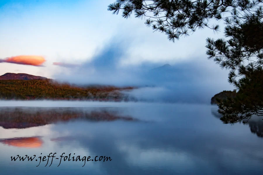
So let’s say for the sake of My ADHD we will focus on staying on Route 16 with just a few scenic side trips. So we leave Chocorua Park (Route 113 and 16) and head north 1.5 miles to Lake Chocorua. Be careful as you will start coming down a hill and you will see water on your left. TURN YOUR SIGNAL ON for a left turn! This will open to a small dirt Parking lot (9 or more cars). There is a porta potty here if you need it.
I continued up 16 to Conway and instead of going up Route 16 into North Conway (where all the outlet shopping is) I took the first turn onto Westside Road and stopped at the two covered bridges (Saco River covered bridge (SB) comes up first and then the SR (Swift River Covered Bridge).
Saco & Swift River Covered Bridges
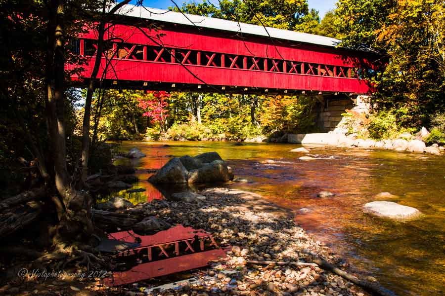
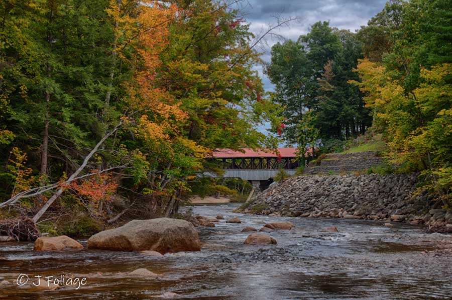
Park when you see the triangle of green space on the right. I got out here and photographed the Saco Covered Bridge. I then drove another 100 yards to the parking lot of the Swift River Covered Bridge. I climbed down the embankment below the bridge from the parking lot for a different view of the Swift River Bridge. That also permits this view of the Saco Covered Bridge once you get below in the river bed.
Echo Lake
Now you can continue on Westside Road until it joins with Route 16 again. Watch for photo ops on the left of Westside Road, 8.5 miles up is the first photo op, Echo Lake.
Echo Lake Road is on your left. Turn in here to see what the fall colors are like. Cathedral Ledge sits on the far side of the lake and can be very pretty.
Cathedral Ledge
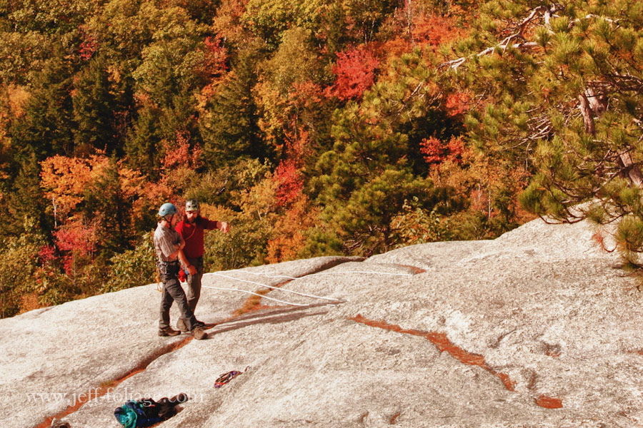
Reset your trip counter here and continue up West Side Road for 1/4 mile to a T-intersection and make a left. After a mile from Echo Lake Road, will be Cathedral Ledge Road on the left. Take this and drive it to the top and park where everyone else is. Then yes, get out and walk. 🙂
You can look out on Conway and also Pinkham Notch to the north. Get an idea of what the fall color looks like from a distance. If you sit there long enough, you can hear the whistle of the train leaving North Conway.
Diana’s Baths
Next, drive back down the hill to Westside Road. Make a left and under a mile on the left, you will see a sign for Diana’s Baths which is a series of waterfalls and depressions in the rocks that form pools.
It’s a short easy walk from the car to the start of the pools. The climb up is not tough, but be careful on the rocks as I fell there once (The story is told only over a beer) 🙂
Get back on Westside Road and travel about 4 miles to Route 302 and Bartlett NH. Turning right onto 302, there will be the Bartlett Covered Bridge on the left. Be warned! They have turned the covered bridge into a gift shop but other than that it’s a nice stop.
Continue east on 302 until the junction of Route 16 and 302. Make a left onto Route 16.
Jackson New Hampshire
About 2.2 miles up on the right you will see the turn-off of 16A. This short loop runs through Jackson NH. The first thing you will see is the Jackson Covered Bridge (No 51) which is also called the Honeymoon Bridge.
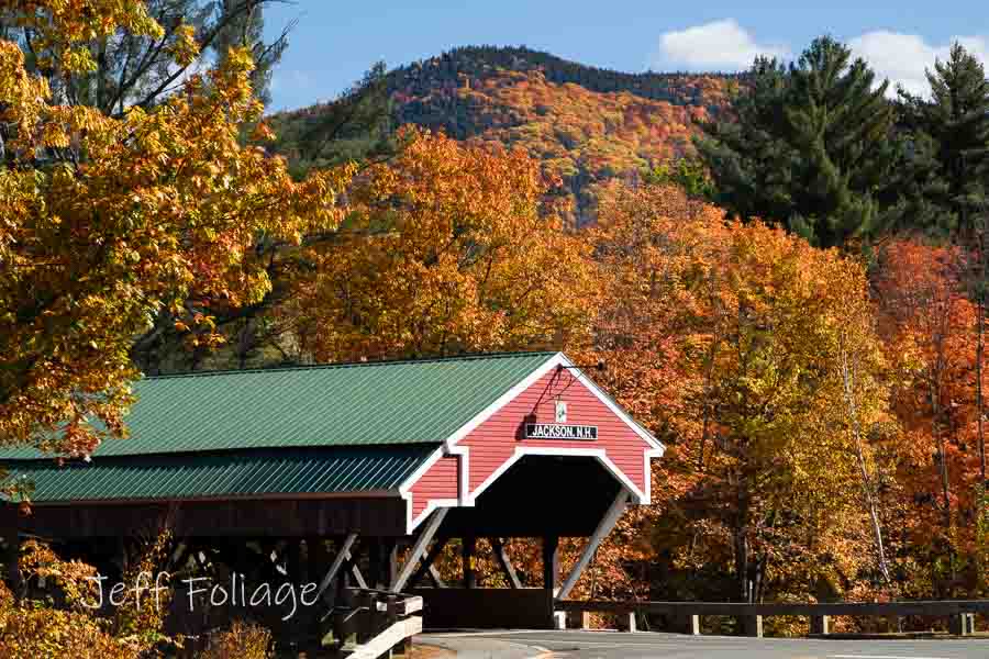
Jackson is a beautiful little village and you could easily spend a day here exploring. The one place I always stop at is the Ravenwood Curio Shoppe (next to the fire station).
Leaving Ravenwood behind, stay on 16A and back to Route 16, and make a right. The next 9 miles will be filled with spectacular foliage views (lots of trees and hills) with several B&Bs.
In a few more miles are the “real” hills. There is a section of Route 16 with some really wide pull-offs making it easy to pull off and park. There are views up and down the valley, not to mention the sides of the valley walls surrounding you.
Pinkham Notch
Travel another 2 miles and on the left is the Joe Dodge Lodge where this trip turns around. There are many trails to get out of the car and investigate. I turned the truck around and headed home at this point but if you are still wanting a little more??? Here is my article that will take you north from Pinkham Notch to Rangeley Maine. (click)
Mount Washington Auto Road
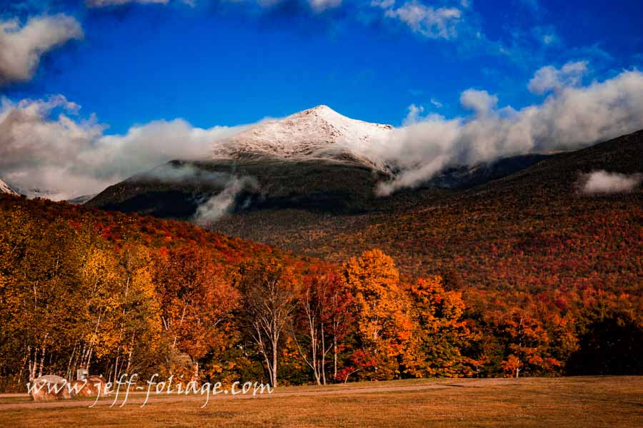
Continue up the road for another mile, and on the left will be the Mount Washington Auto Road. It’s hard to miss the auto road pull-off between the signs and the big mountain. View this link which will take you to my article on what you will find if you drive up Mount Washington Auto Road.
This side trip isn’t for the faint of heart. Driving all the way to the top is an awesome experience and a good way to test your brakes and nerves on the way down. If you have any doubts about your brakes? Take the Cog Railway to the top instead. Here is an image of the train coming down off the mountain. (*note: opens a new window to my gallery!)
Tips for Hiking the Peaks
Wear good hiking shoes and wear layers for hiking. The weather can turn quickly, so if you are doing serious hiking on the AMC trail areas, make sure you either go with a guide or file a plan with the nearest ranger station. Bring water, GPS, and a map (that you know how to read). People have underestimated the mountain in the past and have had to be rescued.
Jeff Foliage Folger
Autumn is a state of mind more than a time of year – Jeff Foliage
- Visit my Fine Art America Gallery
- Visit my Amazon store to pick up New England-related materials
- Follow me on Bluesky
- My Facebook foliage page
- Threads.net/@Jeff_Foliage
- Follow our new Fall Foliage FB Group!
- You can visit Lisa’s Artist Facebook Page by clicking here

Comments
Lake Chocorua to Pinkham Notch — No Comments
HTML tags allowed in your comment: <a href="" title=""> <abbr title=""> <acronym title=""> <b> <blockquote cite=""> <cite> <code> <del datetime=""> <em> <i> <q cite=""> <s> <strike> <strong>