A Covered Bridge and More on the Kancamagus
This captivating article is a compilation of my journies spanning the majestic expanse of the “Kanc,” widely recognized as the awe-inspiring Kancamagus Highway, transporting you effortlessly from its western reaches to its eastern expanses. While it is impossible to encapsulate every facet within a single piece, my explorations along the breathtaking 34-mile stretch have led me to discover a multitude of awe-inspiring vistas, ensuring an unforgettable experience for any traveler.
There’s only one covered bridge along the Kancamagus Highway. But you knew that right?
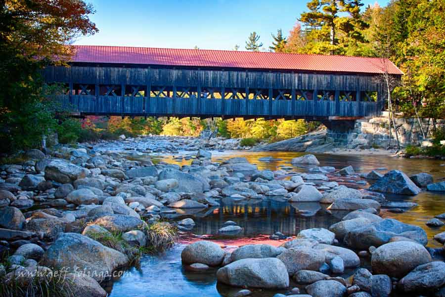
The Albany covered bridge is not really the start or the end of this trip but more towards the middle-ish. But since I titled this article about a covered bridge I figured I’d mention it up front… Don’t worry there will be more about it later on.
You will find the Albany Covered Bridge. Depending on which direction you are traveling, either 27 miles east of Lincoln or 6 miles west of Conway on Route 112.
The Scenic side of the Kancamagus, “The Kanc” Route 112
Your journey to drive the Kancamagus begins in Lincoln New Hampshire and ends on Route 16 just South of Conway New Hampshire. (or visa versa) You can do this trip in as little as an hour or the trip can take an entire day. Remember, there are NO gas stations, homes, or restaurants over its 34.5-mile length, so plan accordingly. At either end, you will find a Ranger Station.
As you get off I-93 in Lincoln the Ranger station is just across from the exit on Route 112. If you are coming in from Conway and Route 16, you will find the Ranger Station on your right as you turn onto Route 112.
Almost everybody has driven the “Kanc” but every year I try to stop and find a new little corner to explore. Some years it’s nothing more than revisiting the spots I really enjoy (or have time to visit). I’m big on crowd avoidance so if it’s the weekend or Columbus Day, you will not see me near here… That is a lie actually, I visited on that weekend, but it’s usually earlier in the day. Why? Because most of YOU sleep in. 🙂
Somethings You’ll Find Along the Kanc (but NOT all)
I have not visited all these things because as Lisa points out I’m always on the go to gather in-person observations so I can make reports for you. But the bolded ones are the ones I have stopped at. I created a video which you will find at the end of the page. It condenses the 45-minute drive (with NO stops) down to about 6 minutes.
- Lincoln Woods Trailhead
- Big Rock Campground
- Discovery Trail
- Otter Rocks Day Use Area
- Greeley Pond Trailhead
- Hairpin turn
- Hancock Scenic Overlook
- Unnamed Panorama
- Pemigewasset Overlook
- CL Graham Wangan Overlook
- Lilly Pond Vista
- Livermore N Trailhead
- Sawyer River Trail Trailhead
- Sugar Hill Scenic Vista
- Pine Bend Brook Trailhead
- Sabbaday Falls Observation Site
- Jigger Johnson Campground
- Rocky Gorge Scenic Area
- Lower Falls
- Albany Covered Bridge
- Saco Ranger Station
.
Starting at the beginning
As you leave Lincoln NH on Route 112 to head East toward Conway, you will pass Loon Mountain on your right, wait a minute… you did… stop… at Loon Mountain and ride the gondola to the top? At the top of the Mountain, you will find Great panoramic views, a couple of stores, and caves for you and the kids to explore. Watch out for the prospectors… They can be a bit protective of their gold…
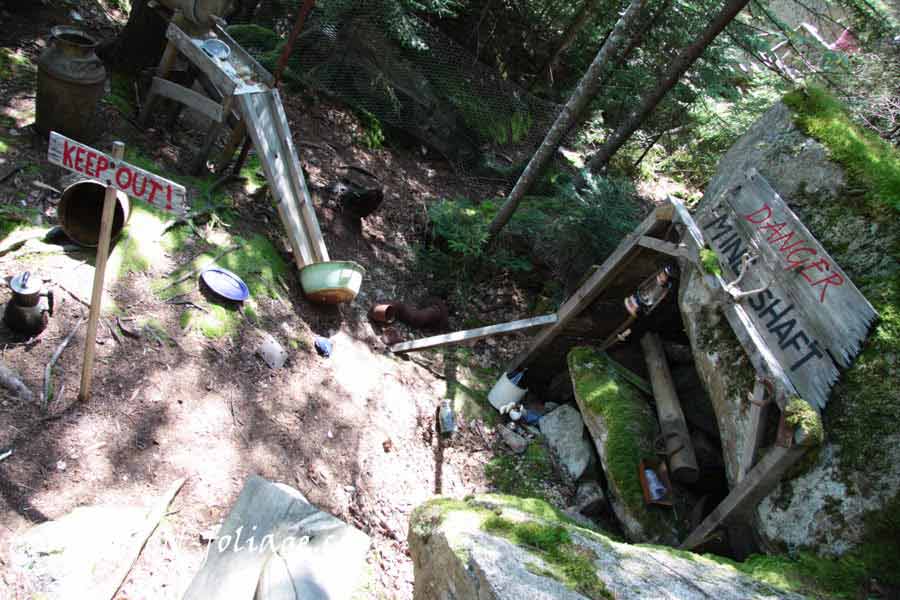
So before you “really” leave Lincoln, you will see the entrance to Loon Mountain on the right and an old steam engine marks the entrance. Allow 1-2 hours for the ride up, exploration, and ride back down. Oh! they also hold the highland games there on the 3 weekends in September (Fri-Sun).
Pemigewasset River
Next, as you travel East along Route 112 (about 2.0 miles) is a bridge where if you glance left you will be looking up the Pemigewasset River. DO NOT try to pull over and instead pull into the Lincoln Woods Trailhead parking lot on the left. This is the first “official” pullout on the Kanc. deposit a few dollars into the pay kiosk and follow the path back to the river.
You could spend 10-20 minutes here or half a day exploring the trails. I’ll leave the time management up to you…
Hairpin Turn and the Hancock Scenic Overlook
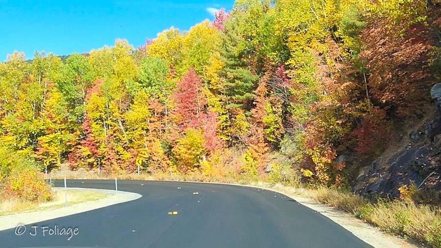
The hairpin turn from west to east is a gentle climb up and the image to the right is from the other direction so you pick up speed as you descend around the curve. Just after you make it around this wide turn (No smuggler’s Notch here).
Right after you pass the big turn you will see high on your right, the first of the “official” Scenic Overlooks. If you have never done the Kancamagus Highway before then feel free to stop at each one.
Each of the Scenic Overlooks have their own flavor and you will have to decide which one you like best.
A Scenic Overlook that isn’t an Official Pullout!
After you leave the East Branch of the Pemmigewasset River at the Lincoln Woods Trailhead, you get on the “Kanc” heading east. You will be going towards the BIG hairpin turn and just after you pass the turn, you will see a little dirt pullout on the right (about 6 miles). (Google Maps now calls this the Unnamed Pullover) There is room for a few cars to pull over and as you nose in your car, you are presented with one of the best views along the Kanc. (see this in the video, it’s very popular)
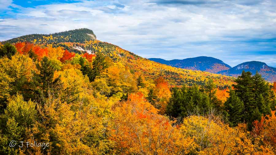
To me, this is one of the better views along the Kanc. Most all the trees have been cut down to provide a stellar view of the surrounding hills covered in incredible fall colors.
Here is the Google map to where you will find this Scenic Outlook that “isn’t” really an “official” outlook.
Panoramic view from the Unnamed Pullover
If there is room then pull over and get out and stretch your legs while you take in the view. The view of looking down the valley is one of the best. This was the view as of 2 October 2012.
To me, this is better than the “official paved Scenic Overlooks that you’ll find later on. But there are four “Official” Scenic Overlooks in a space of 7 Miles. The Hancock Overlook is the first “official” overlook going in this direction. The next is the CL Graham Wangan Scenic Overlook and a few miles past that is the Pemigewasset Scenic Overlook, ending with the Sugar Hill Scenic Overlook.
Continued after the following AD.
I want to let you know that I don’t run “in your face” ADs on this site (BUT… I do have affiliate Ads)
This doesn’t mean I don’t have costs. I have Website costs, hotels/Inns, gas, and of course, cider donuts and my pumpkin spice coffee’s all add up!
If you find what I do to be a service to your fall foliage planning then please think about supporting me in any of the following ways.
- Choose my artwork to put on your walls. Framed prints, canvas gallery wraps along with Home decor can be purchased securely from my online Art Gallery. Even small items like mugs, totes, or puzzles help me out and keep me going!!!
- Purchase via my affiliate links. you may see Amazon-linked products I own , or other affiliates to try out, they pay me a few pennies from your purchase.
- If you book your reservations from Expedia or Hotels.com from my links I also receive a little compensation.
- Purchase my yearly calendars. You have different calendars to choose from with New England images, Fall Foliage, Lighthouses, or covered bridges. This will allow you to explore New England from top to bottom in all seasons.
Want a more direct way? Become a patron by sending directly via my Patron Page. Here you can send via the secure form to Paypal with your debit or credit card. (no you don’t need a Paypal account)
You have lots of pull-offs so make sure you travel slowly. I guarantee that if you are going fast you will suddenly find yourself passing one scenic view after another. The people behind you will also NOT appreciate you slamming on the brakes.
The last of the Scenic Overlooks
This is NOT the last spot that is scenic but it’s the last “official” scenic overlook. I’ve stopped in at Sugar Hill Scenic Overlook many times over the years. Maybe it’s the location but next to the other three overlooks this one is the best. Although I think the “unofficial” Overlook has the best view. Here is a shot from Sugar Hill from 7 October 2022.
Lower Falls River Shot
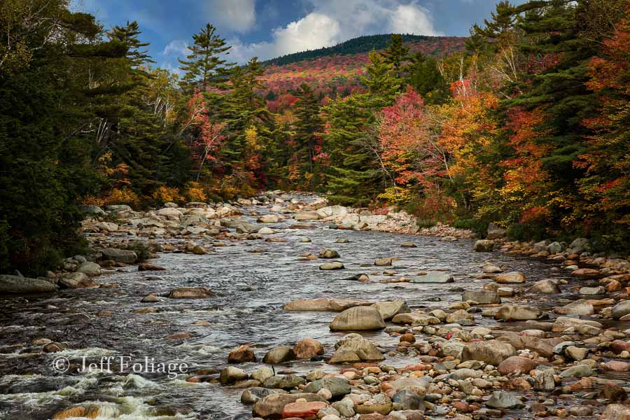
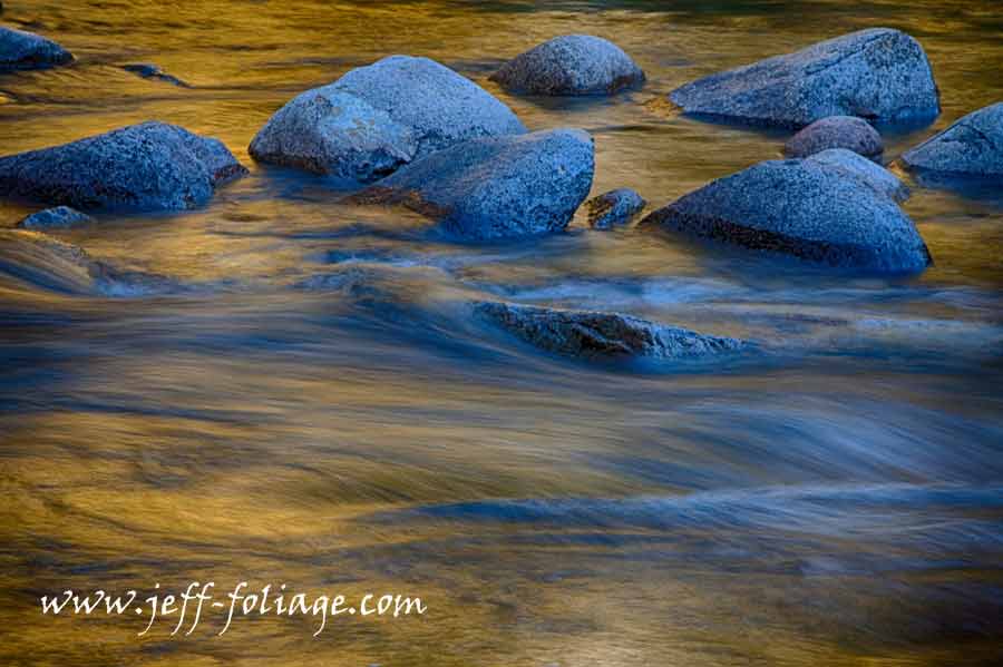
I’m going to skip about 20 or 50 scenic opportunities and have you stop at the Lower Falls. I always enjoy climbing over the boulders that are just past the parking area. If you are lucky to arrive around 3 PM then you should find that the far side of the river is a-glow in colors… (also 1-8 Oct is your goal to get here)
Once you leave the Lower Falls keep your eyes open because you’ll be looking on your left for the entrance to the Covered Bridge Campground.
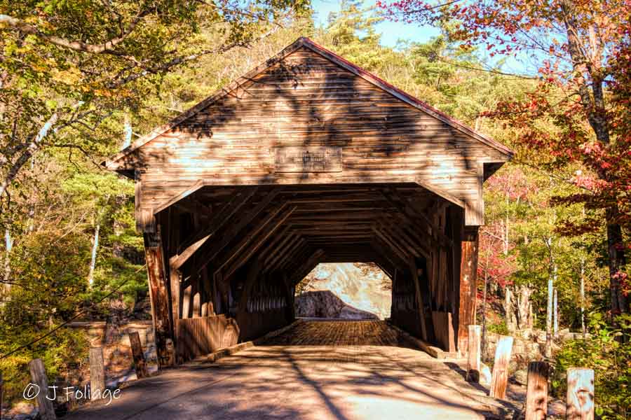
You can pull to the parking lot and find a parking spot. It’s simple from here, just walk to the bridge. Both entrances are very scenic (although these photos don’t show the bars to prevent tall vehicles from passing through) and still worth shooting but my favorite is to cut through the trees and carefully walk across the rocks downstream. Or upstream…as seen in the first photo up top.
Driving the Kancamagus in Autumn Video
You can easily spend a lot of hours on the Kancamagus in autumn. in 2020 Lisa and I were coming back on the 27th of September and I foolhardily decide to leave I-93 and get on The “Kanc” to cut over to Route 16 to head home. I’m glad I did but it was no stops and about 45 minutes.
I left out a lot but, I assume those of you who would like to hike will stop at any of the many trails, and there are the Lower Falls and the Rocky Gorge and more to explore… Good luck and have fun.
Jeff Foliage Folger
Autumn is a state of mind more than a time of year – Jeff Foliage
- Visit my Fine Art America Gallery
- Visit my Amazon store to pick up New England-related materials
- Visit my Pictorem Gallery (Free shipping in the US and Canada)
- My Facebook foliage page
- Threads.net/@Jeff_Foliage
- Follow our new Fall Foliage FB Group!
- You can visit Lisa’s Artist Facebook Page by clicking here



the KANC bridge is always pretty. I saw it a few years ago in the spring.
the KANC bridge is always pretty. I saw it a few years ago in the spring.