Scenic Drive Darling Rd to Burke Vermont
Greetings my foliage friends, today’s scenic drive was a long time in the making. Several years ago I came upon an article in Yankee Magazine, and the writer talked about Darling Hill Road in Vermont. I had trouble following it mentally so I dropped it till Feb 2020.
Now, scenic drives don’t just happen everywhere as much as I tend to think everything is a scenic drive. It’s rare that Lisa and I just happen upon a road that turns out to be a wonderfully scenic drive with lots of farms, barns, overlooks, stone walls, and rustic wooden fences. It is usually the result of some research and that means reading what others have written. I’ll read old magazines and books on New England. Most days I use today’s tools like Google Street View to see if I can tell if it’s still worthwhile.
Using Google Street View to Explore
I have been using Google Street View to explore New England for years. Over the past couple of years, the number of roads that Google has covered seems to be declining but Darling Hill Road was still shown there.
Darling Road is a simple two-lane road that starts paved and then turns to dirt. The “street view” in Google Maps allowed me to “walk” the route. It started off fairly average and then I saw a church off to the left, that was ok, (Chapel of the Holy Family) and the article said there was a monastery. A little further along I could see there were maples lining both sides of the road, NOW THAT ALWAYS catches my attention (see this article on Tree-lined roads), and even though the trees in Google street view were green, this got my heart beating a bit faster.
I “walked” the rest of today’s Route but as much as I wanted to write about it, I hadn’t ever been there so I had to wait till I visited this past autumn. As we all know there were many challenges during 2020 but I made it my priority to travel not once but twice on Darling Hill Road.
Let’s start this from a good beginning point…
Lyndonville VT Scenic Drive in the Northeast Kingdom
I’m starting in Lyndon Vermont where you get off I-91 onto Route 114 and you follow this into Lyndon and then Lyndonville. If you haven’t located the five covered bridges that are in the area of Lyndon and checked them off your Vermont covered bridge list, here’s your chance.
(Don’t tell anyone but I still only have 4 of the 5…) Also, mark off the Sanborn (next to the ramshackle/burned-out motel) The town doesn’t seem to be doing much to keep it repaired. As soon as I get the Bradley, I’ll do an article on all 5. As of our last stop through Lyndonville, the Sanborn looks to be getting cleaned up and the burned-out motel was being worked on.
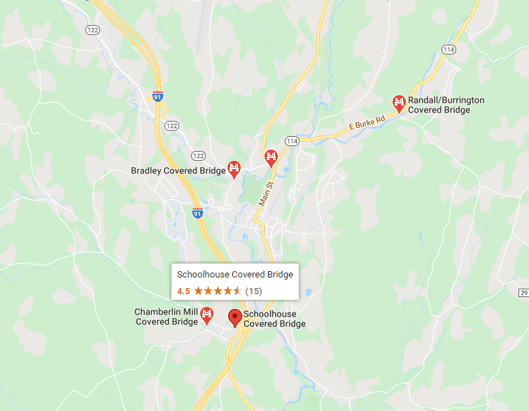
Once you have added these five covered bridges to your collection come back and finish this scenic drive. That’s ok, we’ll wait for you to catch up…
Darling Hill Road
Ok, now that you’ve cleared the covered bridges, you’ll take Route 114 (Main St.) to the North and East, and right after Route 5 splits from Route 114, watch for Darling Hill Road on the left. The third time you cross the Passumpsic River, look for the turn.
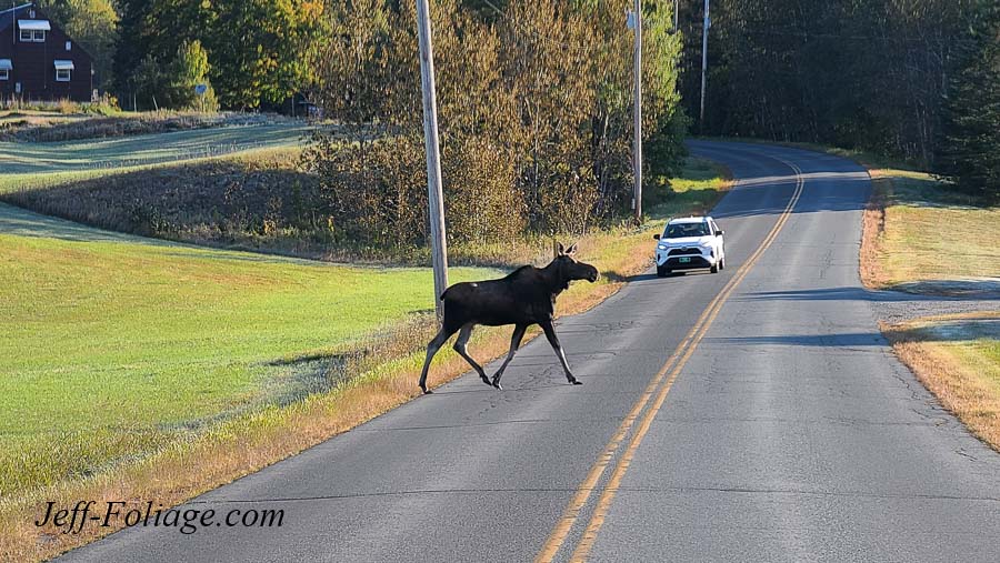
Darling Hill Rd is a quaint little 2 lane road. It starts out paved as seen here but turns to dirt very quickly. Be aware that during the early morning, you are liable to share the road with the larger denizens of Vermont. So please don’t rush up this road.
The Chapel of the Holy Family
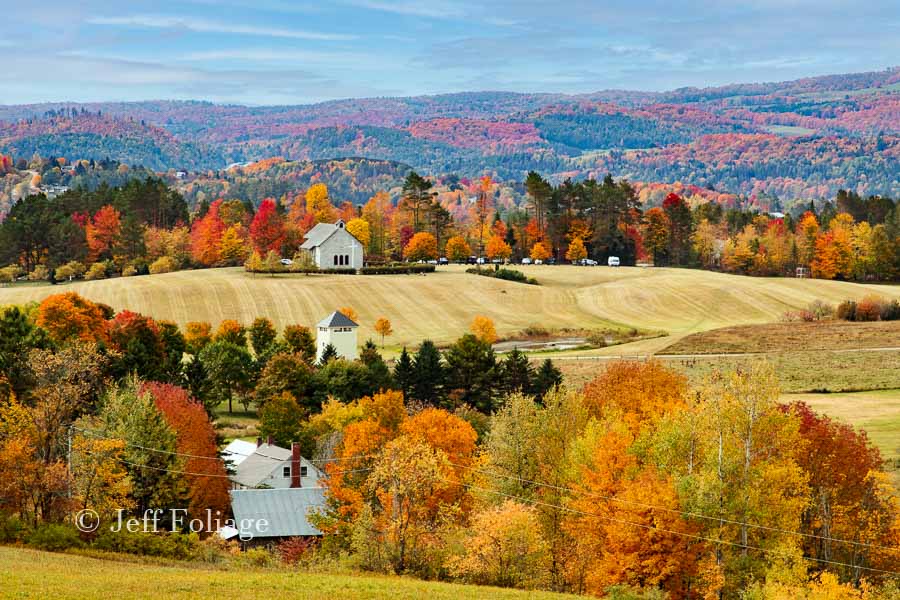
The first item of interest is the Chapel of the Holy Family. As you can see in the image at the top this is not an old white-steepled church and more importantly, this view from the road is just so-so. If you want the view that I showed you up top, you will just have to be patient.
Tree-Lined Road with Maples
As you go just a bit further you will find that both sides of the road are lined with maples. The rest of the route up will have varying numbers of maples along the road. The trees are close to the side of the road creating a tunnel effect which in the fall will be very pretty. I never got it perfectly Peak. I went up on 20 Sept (way too early and this year the fall colors were early but NOT THAT early). I went back up on 27 Sept and the colors were almost there but not quite perfect. (See the image at the top)
Kingdom Trails and Heavens Bench
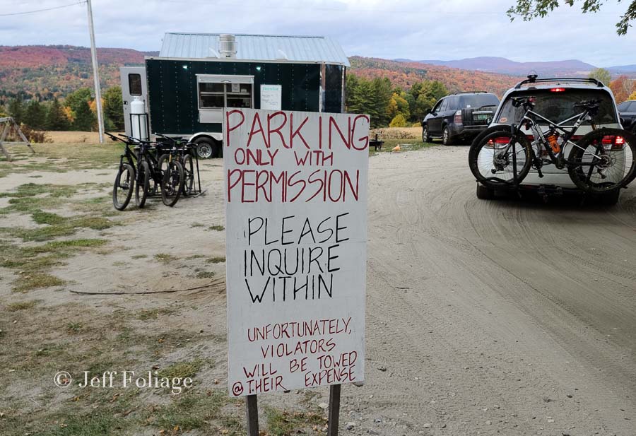
I want you all to remember that this is a narrow dirt road and the road can get busy because of what is ahead. If you are trying to stop and take pictures, stay aware of the traffic. When I visited in 2020 it was slower due to the pandemic but still busy. It was early in the morning but there still was traffic on the road (always when I wanted to get out and capture something).
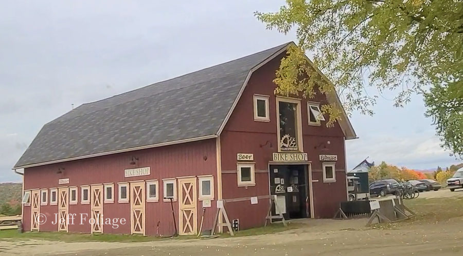
When you get to the Wildflower Inn and the Kingdom trails bike shop there will be a parking lot on the left, BUT!!! these are for the Kingdom Trails mountain bikers and the Inn.
The Inn was not open when I went and there was a sign over near the mountain bike folks (Kingdom trails). It says to check in and ask permission if you are not there to “officially” visit them (read that as pay...).
They were very nice about letting us park there but the parking is limited so keep this in mind when you come up. If it’s a warm weekend afternoon, there may be bike loads of people there to ride the trails.
Kingdom Trail Organization
The Kingdom Trail organization is a non-profit group and the entire area around Burke Vermont comes under their association. Their website, kingdomtrails.org has lists of places to rent gear, find parking, and lodging.
Wildflower Inn
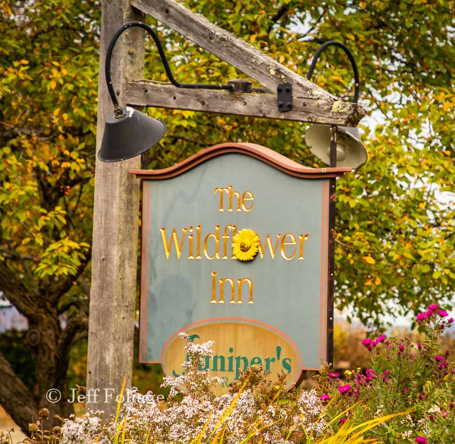
You could also ask permission to park over near the Wildflower Inn (click the link) and ask them for permission. I just talked to them and they say to come in and talk to them since they can make suggestions on where else you might get a parking space.
They closed last Sept and will open in May of 2021. I saw several B&Bs/Inns along this route so if you want to beat the crowds and have a place to stay right in the middle of it all then this is the place for you.
They have information on their site right now but no fall rates yet. You can contact them to find out when they might have an idea of what the future is looking like in Vermont. Keep checking their website to stay up to date.
You may be wondering why I’m going on about the parking… I’ve seen people park along the road near the Sleepy Hollow farm and people on Facebook have told me it was my fault… They felt they had a right to park along a road and impede traffic. That road or this road are not roads you can pull over on and impede/block traffic. So please keep this in mind. If the Kingdom Trails or Wildflower Inn are busy and parking is at a minimum, then THEY have a right to turn you away.
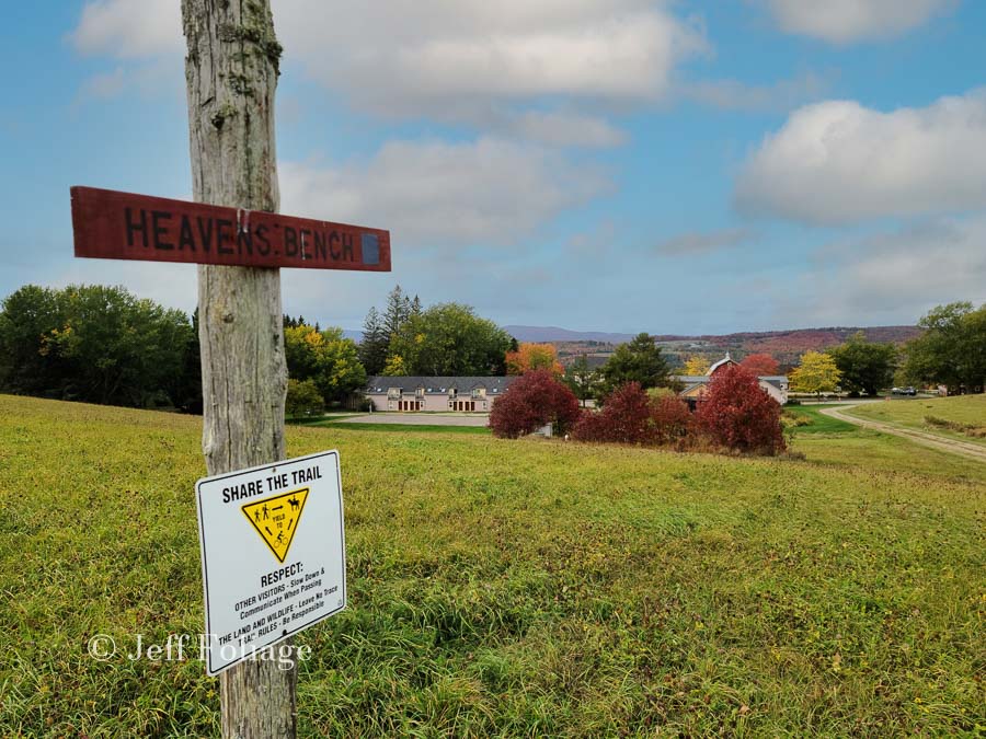
Just across the road from the parking area is a trail that leads to the top of the hill (very easy walk).
Heavens Bench
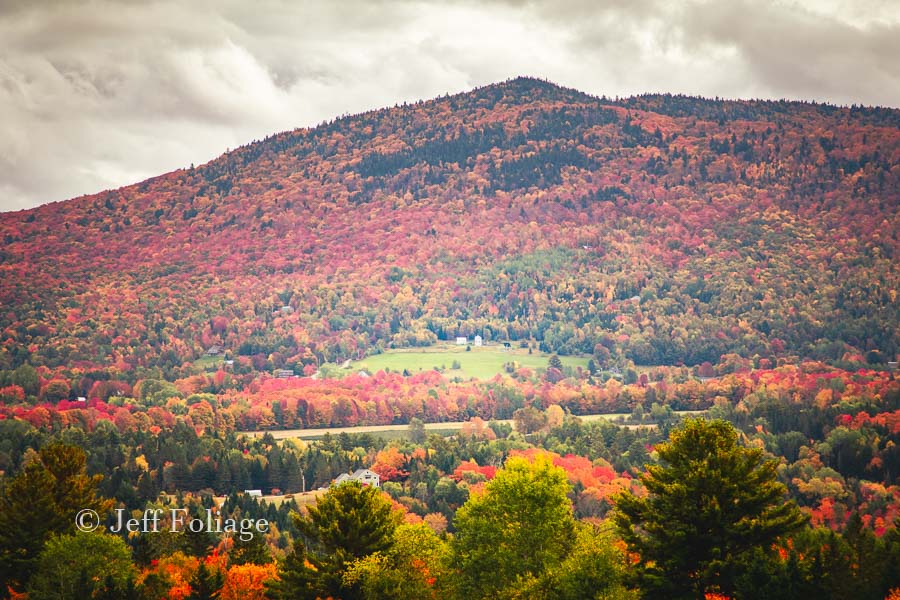
You’re not allowed to drive up to Heaven’s Bench but even those who are mobility challenged “should” be able to tackle it. It’s a short walk up the hill and once at the top, you turn to the right. There are a couple of benches up there and once you catch your breath I want you to continue past the first bench to the second smaller bench to get the panoramic view that I showed you above in the first image.
What makes Heaven’s Bench THE spot to be?
Basically, as you can see from the above picture, It was a little windy that day but you can see from the views from the top that while there are a few hills taller than Heaven’s Bench you are able to see down into the lower hills and valleys and thus why someone thought to call this spot Heaven’s Bench… It must have been named in autumn.
Continuing along Darling Hill Rd.
Up to this point, I’ve concentrated on Heaven’s Bench. But today’s route offers much more (but not quite as spectacular) with farms and barns along this route. You can explore the map below that I created. While there are many side roads that are untested and you can tell by the terrain that the route follows a ridgeline with Route 5 to the west and Route 114 to the East.
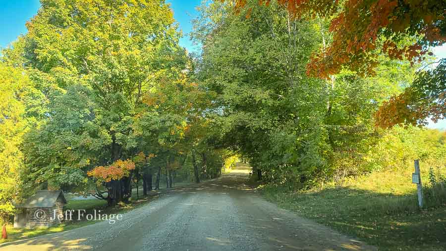
Once you leave the Wildflower Inn, the maples continue to line the road providing many photographic opportunities. Up the road, it starts to get a bit more overgrown. But Everywhere you look are rustic wood fences, barns, and hills providing endless possibilities.
East Darling Hill Rd. will take you to East Burke and a meal but I’m continuing on Darling Hill Road. Soon you will come to West Darling Hill Rd. and this will after a fashion take you to Burke Hollow. But today I want to continue on Darling Hill Road.
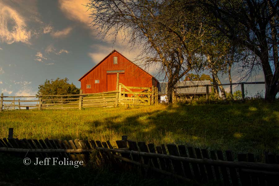
About a half-mile up on the left, you will find a red barn with some great rustic fence lines to put into the picture. You should be able to compose your shots so the garage next to the barn is not in your shots.
Next, we came to the intersection of West Darling and Darling Hill and we stayed straight on Darling Hill Rd, Proceeding to Burke Hollow Which led us to the sugarhouse road sign… Guess which way we went?
Burke Hollow to West Burke Vermont
Burke Hollow Rd is a larger road and you can pick up the pace but as you come into Burke Hollow you will find the Union Meeting House built-in 1825. If you are not into Meeting houses then proceed past but not too fast. You are coming up to Sugar House Road (see the sign above) and have to decide if you are going to take that up into the hills (It said sugarhouse, so I had to take it)
Some side trips to consider
Get the Gazetteer out and locate this road on the maps.
[side note] Sugarhouse Rd continues up into the hills, Newark St. (a right turn) takes you up to Newark Town Offices and the Bald Hill wildlife area and Newark Pond Road takes you over to Newark Pond.
Take Hollow Road just after you pass the Newark Town Offices and follow it to Newark Hollow. Then take Maple Ridge Road South until you get to Schoolhouse Rd. (or go a little further to Cole Rd (my grandson’s name) and then when it turns to Brook Rd follow it back to Burke Hollow) Or stay on Schoolhouse Rd and follow that to where it passes a hill that is 2200′ high and seems to be called (maybe) Spruce Ridge.
If you take Burke Hollow Road, there are a few red barns along the way but I don’t see much of photographic interest until you get into West Burke and jump on 5A and then Lake Willoughby. Let me know what you find by posting it in the New England fall foliage FB Group.
If you stay on Schoolhouse Rd it will bring you out to Route 5A and a short time later to Lake Willoughby.
Sugarhouse Road
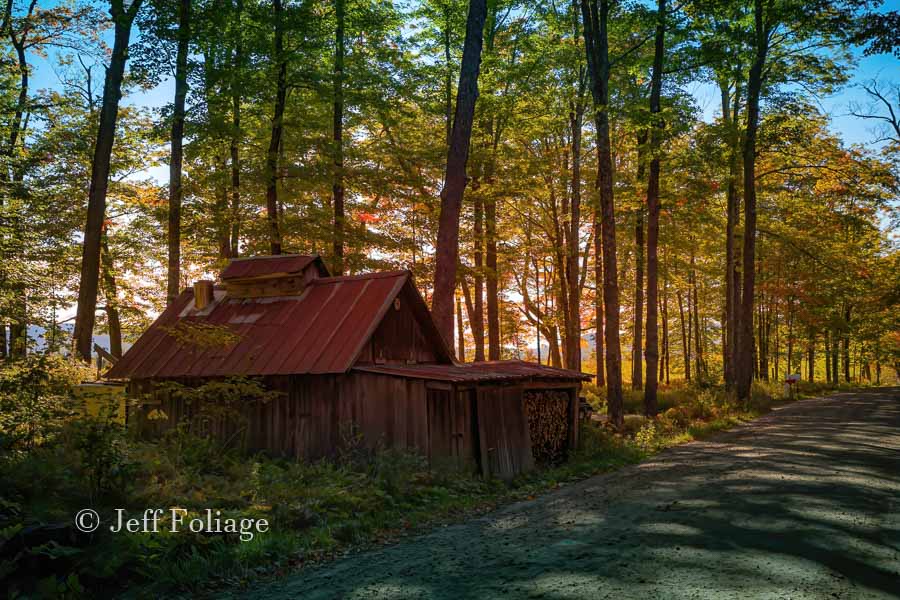
Ok, last on my list today is to follow Sugarhouse Road and it has of all things, guess what? There is a sugarhouse on that road! We followed Sugarhouse Road out of Burke Hollow and it did have me worried once in a while but the road is solid and even sedans should have no trouble.
We left here and made our way to Lake Willoughby. we found some porta-potties because we were a bit leery of going into businesses for bathrooms. We took a new route up into Sentinel State Park (link below) and cut over to Route 14 and then Granby Road to Guildhall Vermont and home. Remember this is a long trip for Lisa and me (3-4 hours from Salem MA)
See the beauty of Lake Willoughby: Turn on West Darling Hill Road to Bugbee Crossing Road to U.S. Route 5 and head north to Vermont Route 5A, which will take you through the Willoughby State Forest. You’ll head along the glacier-carved Lake Willoughby. You can take W. Darling Hill road back where I mentioned it before or after you leave our final spot today.
Nearby Scenic Stopping Points
A Notch Road: If you were going to head over to Montgomery and its covered bridges (see next item below) then take Route 58 to get there. Leave Lake Willoughby on 5A to the North end of the lake and then a left on Route 58. This will take you to Lowell and then up to Hazen’s Notch State Park. (Montgomery and the bridges are next)
Montgomery covered bridges: You could fuel up in Montgomery and See some or all of the six covered bridges in Montgomery (click the link).
Lake Willoughby and the Willoughby Cliffs Natural Area: Pisgah and Mt. Hor rise from the edges of Lake Willoughby. There are hiking trails here made for viewing the foliage.
Hazen’s Notch Road: This road, also known as Vermont 58, between Montgomery and
For the kids
Burke Mountain: Hike, bike, drive or take a chairlift to the top.
The Newport-Beebe bike path: This is a scenic and safe place to walk, run, skip or bike. You can take it all the way to Canada.
Best Instagram spots
Darling Hill Road: A tree-lined local road with spots offering panoramic views, Lyndonville Vt.
Heaven’s Bench: 360-degree views of both higher-elevation hills and valleys below this promontory outlook.
Lake Willoughby: The southern shore where Route 5 meets the lake is a surefire spot for the fall colors after the 3rd of October.
Autumn Northeast Kingdom events
Northeast Kingdom Fall Foliage Festival: Late Sept, Seven days of events in towns around the region. (Check the NEK chamber of commerce)
Bean and Brew Festival: Oct. 13, featuring locally roasted coffees and New England beers, Jay Peak Resort.
This can be a one-day trip or broken up into a couple of days by staying in the local area and being much more thorough than I was here. Either way, you will find too many things to do no matter when you arrive. If you have questions or suggestions leave something in the comments.
Jeff Foliage Folger
Autumn is a state of mind more than a time of year – Jeff Foliage
- Visit my Fine Art America Gallery
- Visit my Amazon store to pick up New England-related materials
- Follow me on Bluesky
- My Facebook foliage page
- Threads.net/@Jeff_Foliage
- Follow our new Fall Foliage FB Group!
- You can visit Lisa’s Artist Facebook Page by clicking here

Thank you so much, Jeff, for bringing us the beauty of New England in autumn. I do look forward to seeing your gorgeous pictures. I can put myself in the scenes . . and hope to do just that in person next year . . if Covid will lessen its hold on us. Take good care of yourself as you travel around.
Thanks Charlotte, I have to look forward with the hope that people will get their vaccinations and things will indeed get better. For now, mask-wearing (IMHO) will be with us for the long term and maybe every flu season we will all have to wear masks but if that means we can get out and explore and see each other again… so be it.
This road is my favorite place on the earth, in peak foliage season! My hubby and I drove this road from Newark Rd to Lyndonville every day sometimes twice a day, on our yearly vacation while staying in a gorgeous log home, owned at the time by one of my older brothers. Best vacations ever! Sadly he sold his property a couple of years ago. We miss it terribly. My heart skipped a beat when I read your article…..❤
I’m glad it brought back some wonderful memories… I’m not a “young” bike person but walking this road in early October would be very nice.