Exploring Vermont’s Fabled Route 100
Route 100 is called Vermont’s Main Street as it captures the rural essence of Vermont.
When it comes to Route 100, people fall into two groups. Those that Have traveled on some portion of Route 100 and those that Will travel it. For those who have heard the stories, there is so much more to the telling.
Vermont’s Route 100 is among one of the most scenic roads we have in New England, but it’s not so much for outstanding vistas as it is for its sheer variety of unique scenic views of the New England countryside. In comparison, the Kancamagus “Kanc” Highway in New Hampshire is known more for the vast sweeping scenic overlooks of the White Mountains.
The “Kanc” has just one barn (Russell-Colbath), one covered bridge (the Albany), and one river (the Swift River) that runs along Route 112. You get the idea, and that is the big difference between the two.
Scenic Variety on Route 100
Variety is what you get on Route 100. You won’t find another single scenic byway in New England that compares with the variety of scenic opportunities. This particular article deals with waterfalls, barns, churches, covered bridges, ponds, general stores, and, well you get the idea…
The problem with trying to drive Route 100 all in a day…
People always ask if they can do this in a day… The answer is not that simple. For instance, I’ve never driven the entire length in a day because I’m looking for the best fall colors. depending on when you arrive, the fall colors may be at peak somewhere along its length, but it’s NEVER along its ENTIRE length.
I’ve written a few articles about Vermont’s fabled Route 100 for the past 15+ years but I’ve only written about a segment at a time. Then a few weeks back, Frank Fosdick left a comment asking for an article on all of Route 100. At this point, I had to accept that I hadn’t really done an article focused on all of Route 100.
Where does Route 100 begin? Or End?
To begin with, Route 100 starts, or ends (kinda sorta) in Newport Vermont right where Route 105 (Highland Ave) leaves Pleasant Street. This is the first instance that you are close to finding Route 100… BUT!! According to Vermont Transportation, their rep said it really starts a bit further south and it ends at the Massachusetts border.
Who, besides me, feels that Vermont should put up a sign as they have for Route 66? Here begins Route 100! Instead, we get a turn to the right, and somewhere up ahead you will find Route 100.
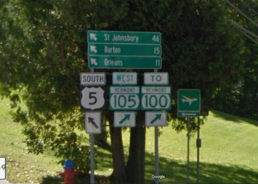
As near as I can tell the first “real” Route 100 sign is spotted at the junction of Routes 105 and 14. From here the Route 100 signs are fairly regular and only get tricky at one or two turns for its entire length.
The limited scope of this article…
Now, I’m only mentioning things that are within a mile or two of Route 100. There are bound to be a thousand things that are just a little further off from 100 that I will either gloss over or fail to mention entirely. So if I don’t mention something that you love, it doesn’t mean I forgot it. IF you feel it needs to be mentioned, then leave a comment below with what and where it is.
Route 100 is 216.7 miles long and is the longest-numbered road in Vermont. You can do this in as little as 4-6, or even 8, hours. “WHAT!” you ask. “It’s only 200 miles! That should only be 3 hours, at most!!!” So, yes, trying to do it all in one day is very easy, IF… you never get out of the car. (If I had a nickel for every time I said this…)
And you could easily drive it in a few hours IF… you were on a highway, but this is a rural road with two lanes (only). You will travel through many small towns that will not appreciate you rushing to pass through at breakneck speed. So please allow 4-6 hours (or preferably a couple of days) if you plan to drive through from start to finish.
Also “pushing through” means NO stops at barns, waterfalls, or a covered bridge or two. I have completed almost all (98%+/-) of the length of Route 100. I did not finish because I got down to what I thought was the end where it meets Route 112 in southern Vermont. I mistakenly continued on Route 112 heading home, thinking I was taking 100 into Massachusetts…
I just noticed on Google Maps (no signs that I noticed) that Route 100 veers to the right (west) and continues for another 13 miles to the west meeting Vermont Route 8 before ending at the MA/VT border.
Maybe someday, the opportunity will present itself to finish it.
Route 100 Points of Interest – from North to South
I will start our little trip by leaving Newport Vermont and talking about a few of the northernmost towns you will pass through. Then we will start to move south into the Green Mountains. Let’s start driving south!
Jay Peak
If you’re coming down on 105, you could climb up to the ski resort village of Jay Peak, but since we are (trying to) focus on Route 100, we will arrive in Troy Vermont. Here you will see Route 10, which also heads north to the town of Jay Vermont (another way to get up there).
For skiers, the big draw in this area is Jay Peak, so all roads try to get you there. Jay Peak provides a stellar skiing location in the winter and an eagle view from various points on the mountain in the fall.
Troy and Westfield Vermont General Stores
The first stop heading south on Route 100 will first bring you to Troy Vermont and the Troy General Store and then a bit further on Route 100 will bring you to the Westfield General Store.

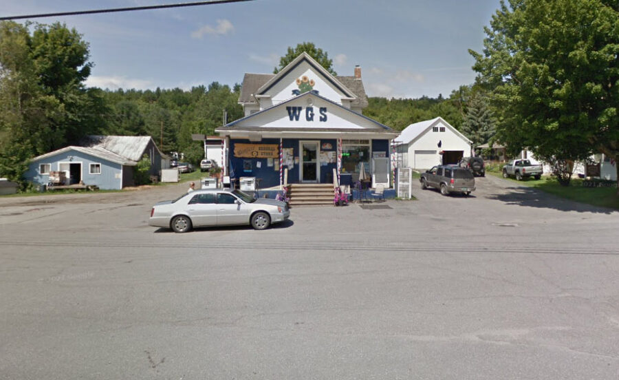
I’ve stopped in the Troy store, and unfortunately, back in those days, I wasn’t really cataloging the general stores, but both stores should serve your needs for drinks and snacks… Maybe I’ll get in there and get them officially added to our General Stores List.
There is a scenic drive (loop) right in the area of Troy. As you come down Route 100, and just before you hit Troy, there is Loop Road which is a 10-15 mile loop that takes you out, around, and back to Route 100. It drops you back on 100 in between Troy and Westfield. I’ve traveled it since I have a friend who lives on it. I’d rate it as worth it, if you have the extra time for it.
Are all towns worth stopping at?
You are going to pass through several towns before you get to Stowe. Eden and its surrounding area (Eden Lake) are worth stopping for, but Hyde Park and Morrisville/Morristown? Maybe not, unless you need to tank up. Morristown is the largest town along Route 100 with a population of about 5,200.
After Morristown, Vermont your next stop is…
Stowe Vermont
When people think of Route 100 in Vermont, they tend to think of Stowe. They have done some great marketing over the years to make sure people associate Vermont with Stowe, but there is so much more to Vermont. I have stayed there one night in the past 20 years and it was only $97, read about not overlooking Stowe for a place to stay.
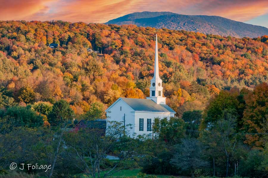
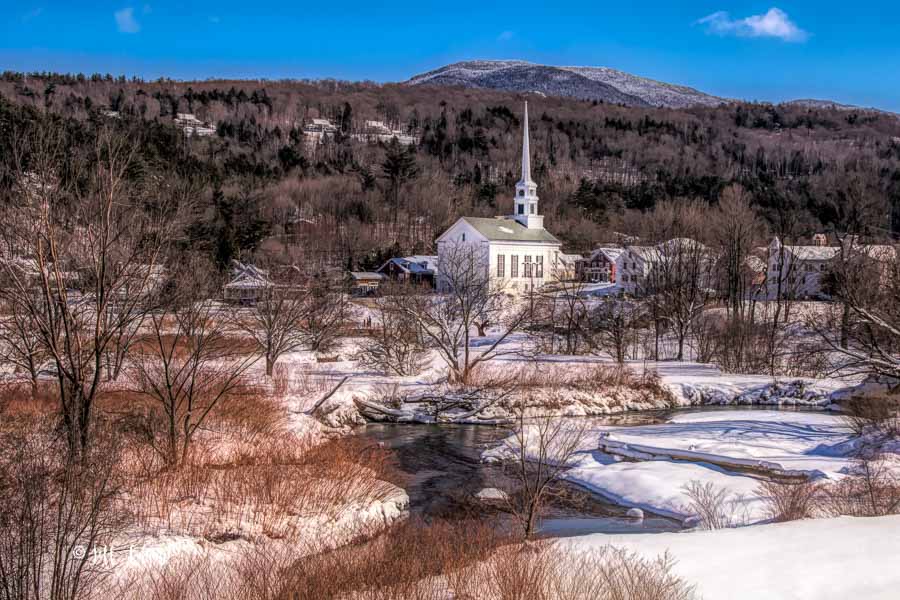
As you can see, my only shots of Stowe revolve around the Church in the center of town. Maybe someday I’ll take my time and walk the town, but there is so much else to see…
Some of the nearby places to Stowe are up on Route 108 as you leave Stowe, such as this view of the Congregational church. You’ll find the best scenic spots will be found by continuing to drive up Route 108 to Smugglers Notch, and either going up and coming back down or taking a drive up and through the “Notch” and circling back around following this route for more covered bridges and scenic sights. (That is IF you are not trying to do Route 100 all in one day)
To be honest, Stowe is so touristy, that Lisa and I stay away from there and pass it by… This is what we are going to do on this virtual tour as well, so we will keep heading south on Route 100…..
Emily’s Covered Bridge (Gold Brook)
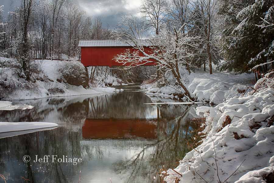
About 2 miles south of Stowe (a little under) will be a left turn onto Gold Brook Road. Then another 1.2 miles and you will come to Emily’s Covered Bridge, also known as Gold Brook Covered Bridge (depending on where you read about it).
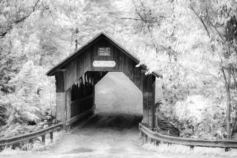
Storytellers say that a young girl died at the bridge. Some say she jumped, or under more mysterious circumstances, fell to her death. I rendered one of my images of this bridge in infrared, which to me gave it a good haunted feeling. Stop in and see if you can hear her crying some evening in the fall.
Cold Hollow Cider Mill
Once you retrace your ride back out to Route 100, continue south for about 4.5 miles. You will arrive at Cold Hollow Cider Mill.
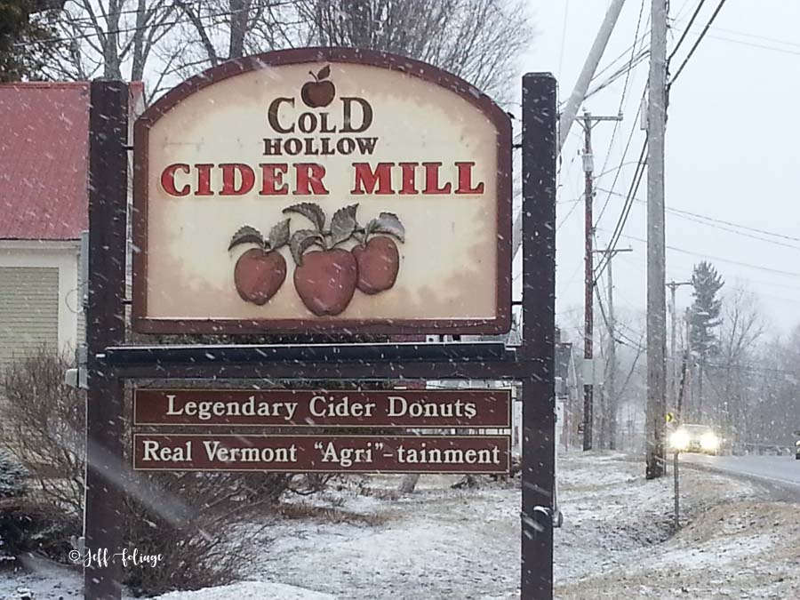
Obviously from this picture, Cold Hollow Cider Mill is open year-round. In the fall, Lisa and I will drop in and get a couple of cider donuts, and if it’s a warm fall day get a cold apple cider. On a colder day, like this one in the picture, I’ll go for a hot apple cider instead. (a win-win scenario)
Ben & Jerry’s Flagship Store/Factory
About 2.3 miles further south on Route 100, as you pull into Waterbury Vermont, you will arrive at Ben & Jerry’s which is the Vermont-based ice cream chain, known for its creative, cleverly named flavors. What is your favorite flavor? (Cherry Garcia is mine, but I haven’t found one I don’t like).
Moretown, a side trip on 100B over to the “Northfield 5”
After getting some ice cream, you will continue down Route 100. As you come into Moretown, you can fill up your gas tank, and you will see a turn-off for a route 100 spur they call 100B. I have gone this way a few times to fill up and then take Moretown Mountain Rd over to Northfield Vermont and photograph the Northfield 5 covered bridges.
The Northfield 5 is so named for the five covered bridges (all painted red) in Northfield and Northfield Falls Vermont. You can find all five along Route 12 and 12A. Yes, this is more than the “mile or so” that I said I would point things out (it’s about an 8-mile diversion on a bumpy dirt road), but it’s worth it.
Waitsfield & Pine Brook Covered Bridges
Now back on Route 100 South, you will find, at 2 and 4 miles further, two more covered bridges. The turn for Pine Brook Covered Bridge is around 2 miles past Ben and Jerry’s, and off to the east another mile or two. Then almost two miles more on Route 100, you will come into the town of Waitsfield where the Waitsfield Covered Bridge carries traffic over the Mad River. They have a live traffic cam pointed at it that you can view on YouTube, and you can watch the river drift by as the cars pass through the covered bridge.
Warren General Store
The next few Route 100 stops will be just off 100 in Warren Vermont. I want you to set your trip counter when leaving the Waitsfield Covered Bridge, and at about 4.7 miles, there is a left turn off Route 100, onto Main Street. Slow down and look on the right for the Warren General Store. We’ve stopped in there before and gotten sandwiches. They also have a webcam too, so you can watch folks coming and going here. Maybe grab a sandwich, or cheese and crackers, and some drinks here for a picnic later.
Warren Covered Bridge
Just down the block on the right, you will find the Warren Covered Bridge. This one has a confusion factor built into it because the sign on the front of the bridge says Lincoln Gap which is a road that you will find out off of Route 100 just across from the covered bridge. If you’re curious about that story, read my article about the bridge here.
Warren Falls
Just a little further down Route 100 (less than a mile) on the right, there will be a dirt pull-out area. From the pull-out, a short path leads to the stepped waterfalls of Warren Falls. It would be a nice place to eat your picnic from the general store.
Moss Glen Falls
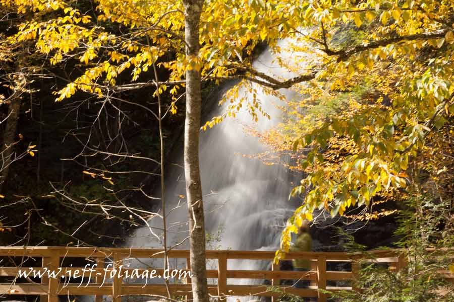
Keep heading south 6.5 miles on Route 100 from Warren Falls, and we have another even easier waterfall to get to. Moss Glen Falls has a large paved parking area and is right on the side of Route 100 (click this link for my article).
Usually in the fall, the water flow is light, but if you are lucky it rained in the last day or so and you’ll get a good show. Also, this is a very easy waterfall to photograph in the winter when this is a frozen marvel. Click here in the description to view more of my Moss Glen Fall images.
Route 100’s famous, or not, Little Red Barn
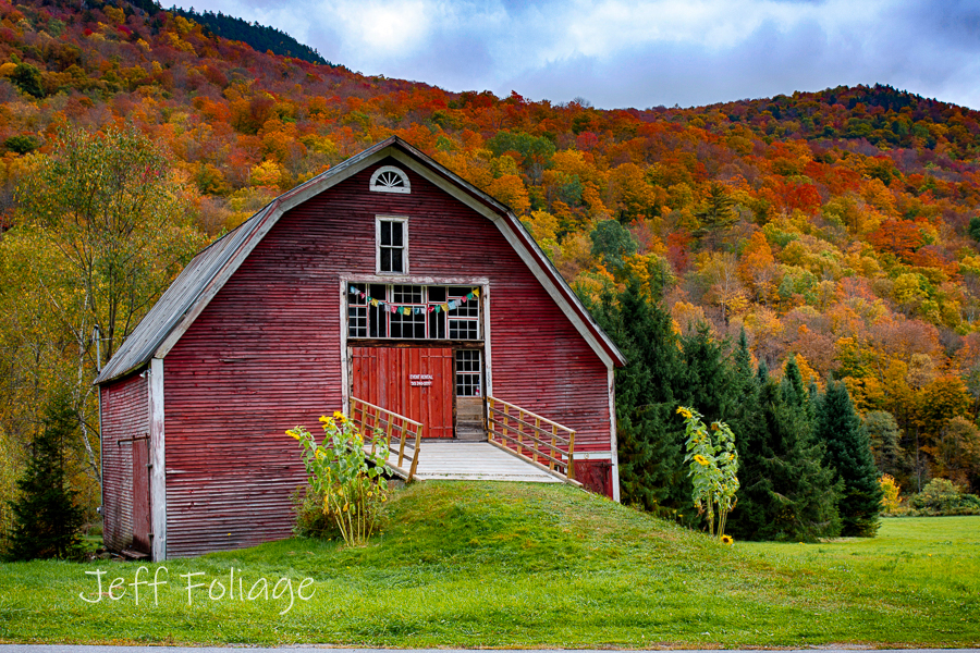
Just north of Hancock Vermont, you will find the little red barn. As always, I want you to be very careful where you pull over to photograph this barn. *Neither side of the road has much pull-off space so don’t go over the hill and pull over (from either direction) You don’t want someone to come over the hill and find you partway in the road, Nuff said!
Just shy of a mile south of Buffalo Road you will find the little red barn. I have been photographing it for the better part of 15 years (or more) and I’ve seen it go from a barn for hay to an event listing for weddings. You may be ready to write this off because it’s too upscale but I think the improvements are very nice. Check these images that I’ve taken over the years and the barn doors go from rotted wood to a very nice entrance. They lowered the height of the doors and added a very unique multi-pane window for natural light.
Hancock Vermont
The next town south is Hancock Vermont. From here you can pick up another side trip, if you have the time, on Route 125. It will take you into the Green Mountains, and over to Middlebury. Along this route will be Texas Falls, the Middlebury College Snow Bowl ski area, The Breadloaf Inn (not a place to stay in), and the Robert Frost Wayside. Everything along this route can be really pretty around 10 October.
Robert Frost had a little cabin on a farm along Route 125, and on Robert, Frost Road is a parking area. Read more about the Ripton chapter of Robert Frost’s many abodes here.
Rochester Vermont
Further along is the town of Rochester Vermont. This is your classic small Vermont town where you will find shops and an art gallery to explore. Just south of Rochester is another road west to cross over the Green Mountains. Route 73 will take you up and over to Brandon VT and connect you to Route 7. Route 73 is a very nice paved road with other back roads to explore, and several hiking trails. Mount Horrid sounds inviting, right?
Lisa and I have stayed in Brandon at the Brandon Inn and you can read our write-up here. There are a few covered bridges in that area as well.
Ski areas along Vermont’s Route 100
I chose to put this section at the point where you would be arriving at Killington Ski Resort. But Route 100 is called Skiers Highway because from Mount Snow in the south to Jay Peak in the north, Route 100 gives you access to all these mountains and their views.
I wrote an article on this subject already so please visit “Route 100 is the Skiers Highway” to check out the options that you can take advantage of by visiting a ski resort in autumn.
Water Wheel Trading Post
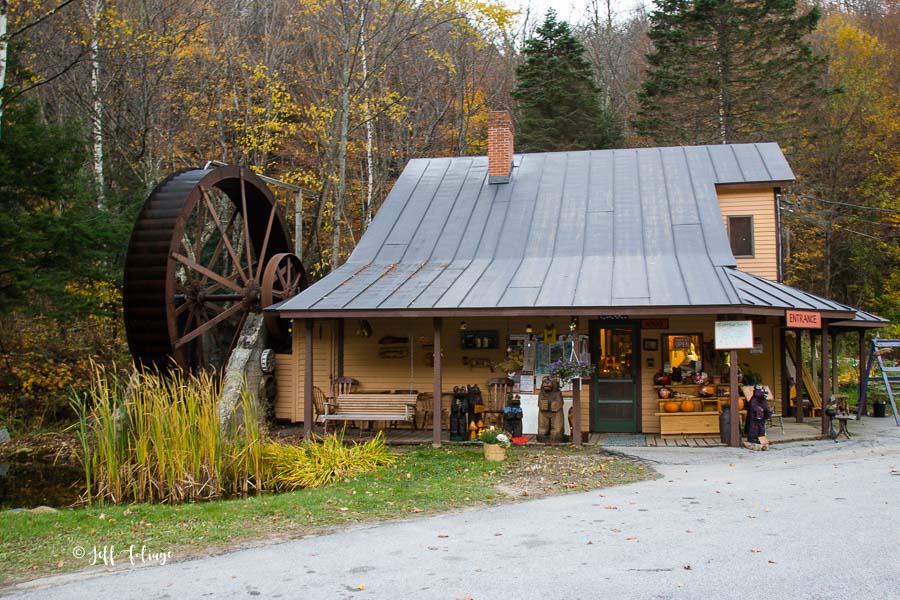
Just after Route 100 joins Route 4, you will notice high walls on both sides of the road. At this point keep your eyes open for the Water Wheel Trading Post. Maybe not a “destination,” but a nice place to stop and see the products, stretch your legs, get a bite to eat, and maybe fill up.
Plymouth Vermont
Last year, (2021) we were on Route 100. Lisa had on our list of things to do, The Calvin Coolidge Historic site. It’s just up from Route 100 on the Route 100A spur which takes you past Plymouth Vermont. You can read more about Plymouth, and the Calvin Coolidge Historic Site in this article about A Tale of Two Presidents from Vermont.
Echo Lake
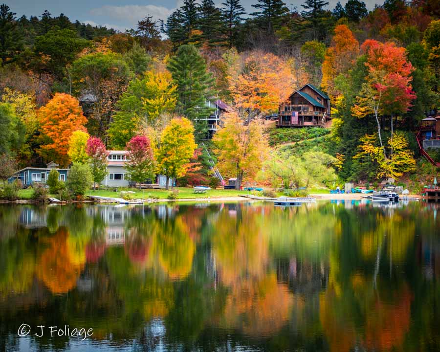
Coming down Route 100, about four miles after leaving Route 100A spur, you will see Echo Lake. Depending on when you hit this point will determine how close to the peak it is and whether you need to stop.
I was here on 4 Oct in 2020 (an early year) and it was pretty. but still early. I would not expect it to be really beautiful until 10-15 October. But would you be disappointed if you saw this view?
Weston Vermont
Weston Vermont has many things to recommend, from the Vermont Country Store to the Vermont Mill Museum. But please visit this article on Exploring Weston Vermont. (also includes a covered bridge)
Jamaica
We stopped at a little coffee joint here in Jamaica (Jamaica Java) and usually, this is all we stop for… How about you? Do you have a story to tell about Jamaica Vermont?
Townsend Vermont
Townsend is another side trip on Route 30 after you leave Jamaica Vermont. Lisa and I stopped in at the Townsend Dam Diner for a bite and the Dam Diner was “dam” good. As we were leaving I noticed a very picturesque barn across the road up on the hill. I decided to walk up the driveway. There was a sign on the mailbox that said Ranney B&B.
Normally I would not enter someone’s property to get a picture, but since they are a business…..it invited me to come up… Well, that is my story and I’m sticking to it.
The End of Route 100?
Nope! The road is not really done at this point but I think I’ve given you enough to think about for your next trip, or two, into Vermont and along Route 100. I’ve probably left out a hundred things, and some of you are screaming at your screens, questioning how I could have left this, and that, off. (again, post a comment to let me and others know what I missed)
I could mention each and every little barn that I’ve seen along the road like last fall when I found a big red barn with a red shed next to it with an American flag on it. (right near Weston VT) Yes, I left some things off because I had to quit at some point. I also want to set you on your way and let you do your own explorations. I know I have been so happy when I discovered a new location (new for me) when I wasn’t expecting it. This makes the joy of finding it so much greater.
Good luck in your travels my friends…
Jeff Foliage Folger
Autumn is a state of mind more than a time of year – Jeff Foliage
- Visit my Fine Art America Gallery
- Visit my Amazon store to pick up New England-related materials
- Follow me on Bluesky
- My Facebook foliage page
- Threads.net/@Jeff_Foliage
- Follow our new Fall Foliage FB Group!
- You can visit Lisa’s Artist Facebook Page by clicking here


Jeff thats a great overview of rte 100 ,,, gotta love 2 lane roads… the best way to travel
When you’re not in a hurry, definitely. Or the dirt roads where you don’t exactly know where you are going, or what you will find…
Jeff thats a great overview of rte 100 ,,, gotta love 2 lane roads… the best way to travel
When you’re not in a hurry, definitely. Or the dirt roads where you don’t exactly know where you are going, or what you will find…
WOW You just brought back so many great memories about driving Route 100 in October…We always stop at Cold Hollow Cider to get cider doughnuts and cider.. I don’t think that you appreciate the true beauty of Route 100 until after your trip and you start looking at your pictures and remembering the uniqueness of Route 100 .
Thanks Jeff
Thanks Hoss, I hope to have that effect on folks. I always enjoy any excuse to get on 100 and just drive to see if I can find something new…
The covered bridge looks like one of the shortest I have seen. Great article, makes me want to go.
Actually, I think the Schoolhouse covered bridge up near Lyndon Vermont is quite a bit shorter. But the Gold brook is 50′, the Waitsfield is 107′, and the Pine Brook is 48′.
The Schoolhouse covered bridge is 42′ BUT… is it the shortest? My very unofficial guess is that one of the shortest is the Bests covered bridge at 37’… Maybe someone will research it and let us know…?
Thank you for another great article. Your articles are so helpful. I would like to point out a place to take pretty sideview pictures of Waitsfield Covered Bridge. There is a parking lot on the east side of Route 100 – just south of Bridge Street It is a great place to take pictures of the covered bridge.
Thank you for another great article. Your articles are so helpful. I would like to point out a place to take pretty sideview pictures of Waitsfield Covered Bridge. There is a parking lot on the east side of Route 100 – just south of Bridge Street It is a great place to take pictures of the covered bridge.
How is Rte 100 on the Fri of CDW? Our current itinerary has us starting in Newport VT on Wed 10/8 and working our way south to the end on Fri 10/10. We are driving a camper van which is easy enough to maneuver and park until the crowds really take over and parking becomes scarce.
Well as I mentioned under the subheading: The problem with trying to drive Route 100 all in a day…
The fall colors may be at peak somewhere along its length, but it’s NEVER along its ENTIRE length at the same time.
I think you should find really good fall color from Lowell Vermont to Killington on or about CDW.
This window can or will slide depending on what we get in the way of weather between today and 1 October. The more balanced the temps and rainfall and if the Sept temps drop down and hold 65-70 daytime and 35-45 at night and sunny day with only light rain during this month… then it will be awesome…
I hope this helps
Hi Jeff, I want to go on a trip by myself for a week, Oct 5th—12th. I’m coming from Florida. I was thinking about flying into Burlington and renting a car so I have the flexibility to roam. Where would be a good place as a midpoint to stay as an older single gal? I would use this as my launching spot to drive around for the week. Thanks!
Well I would draw two parallel lines. Each a East//West horizontal line. One of them through Stowe (or just north of that) and one through Woodstock to the South. Then choose anyplace in between. I find Woodstock to be pricy but it is a beautiful village and while I consider Stowe to be as pricy, I have stayed there and one night was only $90 bucks… So click the Hotels.com on my page (or the thrifty Lodging page) and see if you can find any deals.
Even Craftsbury won’t be too terrible for driving but being at an Airbnb further south might be better. I’m still seeing some prices from $129 to $225… Good Luck
Thank you! I have stayed in Waterbury before and found it charming and accessible to the main routes. I saw and Airbnb there for $106 per night. I think I’ll snag it. Thanks for your insights!
Thanks so much Jeff! Looking forward to following your tips!
For foliage, I read here recently that route 100 in Windham County is particularly scenic: https://www.boston.com/travel/travel/2023/09/22/new-england-best-fall-foliage-road-trips/
Windham County is quite far south. I wonder if you agree? Is it particularly special in Windham? Otherwise I was thinking of stopping around Echo Lake, since I’m coming from Stowe and going all the wqy down to Windham County is a bit much. Thanks!
This part of 100 is as good as any other. and further south may be better. I myself drove through eastern Massachusetts today ind it was very bright color wise and I think it will get better this week into next. check my Facebook page for picts from today… https://www.facebook.com/NewEnglandFoliage/
I haven’t had any reports for Vermont since I was on the road all day but I would look at my facebook group https://www.facebook.com/groups/newenglandfallfoliage
And see what people are posting… (that is what I’m doing)
Is it a rough trip towing a 41ft fifth wheel with a dually? Been a long time since I’ve been up that way
Well Sue, in answering this I will assume you have one or two spots reserved for the RV. I see RV’s that big or bigger but I assume they are staying at a KOA or similar RV park. Even her in Salem you could get a rig that size out on Winter Island. (Right on Salem harbor and I can’t think of a better way to wake up in the morning) You use ReserveAmerica.com…
That size rig will work on most of the main roads… BUT in Vermont stay OFF Route 108… Take my word for it, I’m not sure if your truck will make it through the notch (Smuggler’s Notch) If your GPS says take Route 108 I want a foghorn alarm to go off in your head.
Unless your truck is built like a slinky and can bend in half to go around several of the switchbacks in the notch… assume you can’t.. and a double no for the RV…
But Route 112 in New Hampshire (the Kancamagus) or Route 7 or 100 in Vermont, not a problem… Hmmmm Route 113 in Maine would be a tight fit as well, It’s paved but two cars passing (one lane each way) have to be careful…
I suspect it’s no different that where you are now and you just have to read the maps/GPS correctly to know if its a primary road, secondary or dirt road…