Explore a Hidden Scenic Drive in Vermont’s NEK
So, you’ve done Smuggler’s Notch and want to go find another scenic drive. You might say What hidden scenic drive? Vermont’s Routes 14, 15, 5, and 5A are ALL WELL KNOWN. But it’s “HOW” you connect them all together that makes them interesting! Today we’re going to connect a Stone house, 3 covered bridges, four towns, one lake, one pond, and who knows what else you may find… If you find something neat that I missed, stop back and leave a comment to let us know we missed something!
OH, NEK stands for the Northeast Kingdom… It’s a real place, google it…
Wolcott Vermont and the Fisher Covered Bridge
Let’s leave Stowe on Route 100 heading north to Morrisville. From there take Route 15 heading east to Wolcott. There are several historic buildings on School Street (Turn off just after the Post Office as School St. parallels Route 15), the Old Historic Schoolhouse, and the Old Wolcott Train Station next to the town offices. There is also the Wolcott Rail Trail Gazebo. If you want to stretch your legs, the Lamoille Valley Rail Trail (walking trail) follows along the Lamoille River.
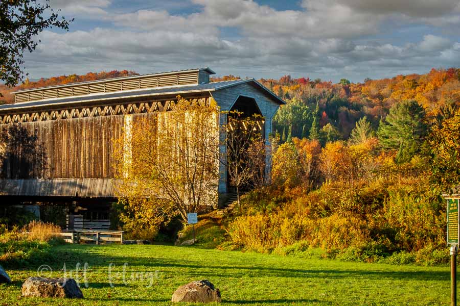
Continuing down Route 15, you will find the Fisher Covered Railroad Bridge. It was the last rail-covered bridge in use in the country, being retired in 1994. There is now a dedicated parking lot for the bridge and you can walk around the area. It is not listed in the old DeLorme Gazetteers as a covered bridge, so you have to know about it from other sources. (Like here!)
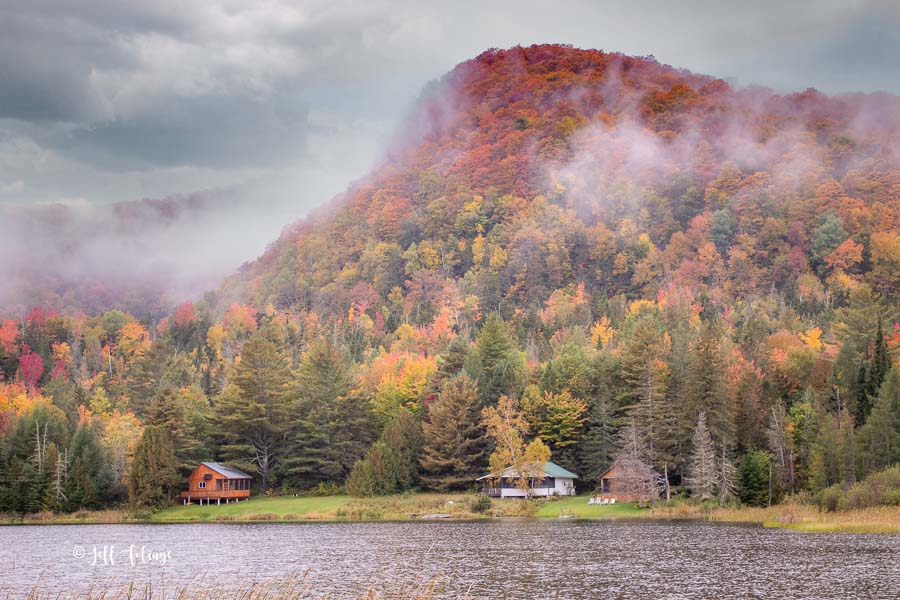
Route 15 continues to meander along the Lamoille River. We will head north by taking Route 14 (Craftsbury Road) toward Craftsbury. You’ll pass by Hardwick Lake and there is a large pull-off if you want to stop and view the lake. Continuing north on Route 14 you’ll find other small ponds and Lakes and a few have pull-offs.
I want to let you know that I don’t run “in your face” ADs on this site (BUT… I do have affiliate Ads)
This doesn’t mean I don’t have costs. I have Website costs, hotels/Inns, gas, and of course, cider donuts and my pumpkin spice coffee’s all add up!
If you find what I do to be a service to your fall foliage planning then please think about supporting me in any of the following ways.
- Choose my artwork to put on your walls. Framed prints, canvas gallery wraps along with Home decor can be purchased securely from my online Art Gallery. Even small items like mugs, totes, or puzzles help me out and keep me going!!!
- Purchase via my affiliate links. you may see Amazon-linked products I own, or other affiliates to try out, they pay me a few pennies from your purchase.
- If you book your reservations from Expedia or Hotels.com from my links I also receive a little compensation.
- Purchase my yearly calendars. You have different calendars to choose from with New England images, Fall Foliage, Lighthouses, or covered bridges. This will allow you to explore New England from top to bottom in all seasons.
Want a more direct way? Become a patron by sending directly via my Patron Page. Here you can send via the secure form to Paypal with your debit or credit card. (no you don’t need a Paypal account)
Things to Explore around Craftsbury VT.
Just past Lake Eligo, we then turn onto South Craftsbury Road, into Craftsbury Village. You’ll see Pete’s Greens, a little farm stand, on the left (4-season farm stand).
If it’s time for some refreshments, there are two stores in Craftsbury. The first you come to if you are following this route is The Genny Craftsbury-Craftsbury General Store. This store is a little more progressive, with a healthy, “natural”, as we used to say, crunchy-granola feel.
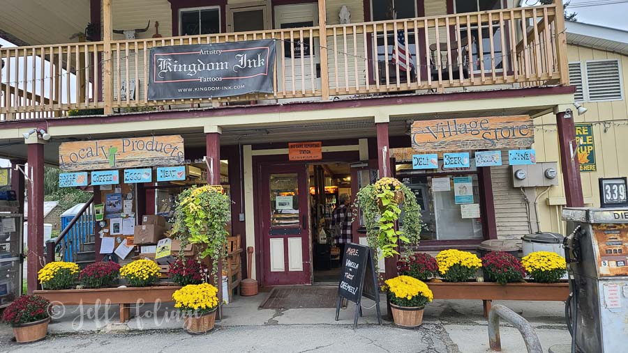
The other store is Craftsbury Village Store. This store is more geared toward the local folk with pizza and other more unhealthy options. Both have very nice delis with food and drink options. No sit-down options for either place.
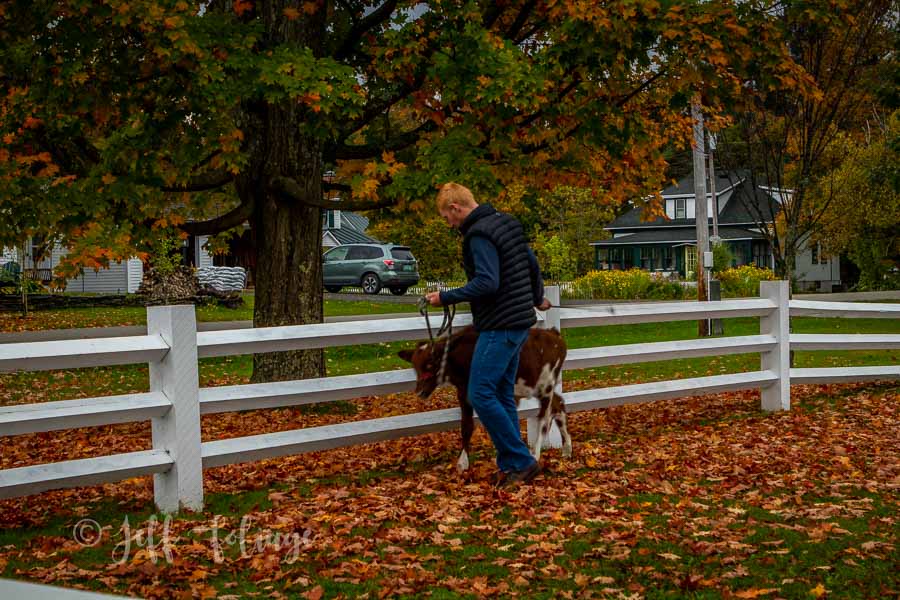
As we continue to travel north on Craftsbury Road, South Craftsbury Road now becomes North Craftsbury Road. We climb a hill and find Craftsbury Common, home of the (private) Sterling College. There is a beautiful town green here and who knows what you will see on the common. Here, a young man is teaching his heifer, a young cow, how to respond to commands.
Note: you train your dog to obey you and in the country, they train their 4H entries to follow them.
Lord’s Creek and Orne Covered Bridges
Leaving Craftsbury Common you will continue on N. Craftsbury Rd. and enjoy the pastoral settings. As you come back onto Route 14, you will turn right, heading further north, through the pleasant town of Albany Vermont (about 4 Miles) but don’t blink because many of these “villages” don’t have much in them to mark their location. Then onto Irasburg (about 7 miles) where we are going to track down a couple of covered bridges.
Lords Creek Covered Bridge (Pvt)
It’s not a secret covered bridge but because this bridge is not “public”, I don’t consider it a counter so it’s up to you as to whether you go and get this one. It’s also not pretty…So it’s your call.
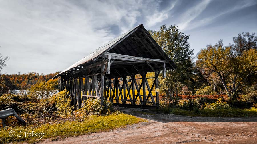
At Irasburg you turn right onto Route 58 and then go 1/2 mile and turn left on Covered bridge road (Note this IS NOT the same covered bridge Road for the next bridge). The Lords Creek Covered Bridge is a short 86 feet bridge spanning the Black River. It is accessible via this road but you can’t cross it because it goes into a farmer’s field past the bridge. This private bridge “CAN” look good in early Oct (between 1 -8 October).
The easiest route to get to the NEXT covered bridge is to continue on “THIS” covered bridge road till it intersects with Route 5 and make a left towards Coventry Vermont…
Orne Covered Bridge
As you continue on Route 5 toward Coventry Vermont you will be looking for Main St on the left. Turn onto Maine Street, there is a statue in the middle of the triangle of roads and you are looking for a crossover on the left and angle back onto covered bridge Rd. (again, it’s not the same road for the Lord’s Creek CB, as before)
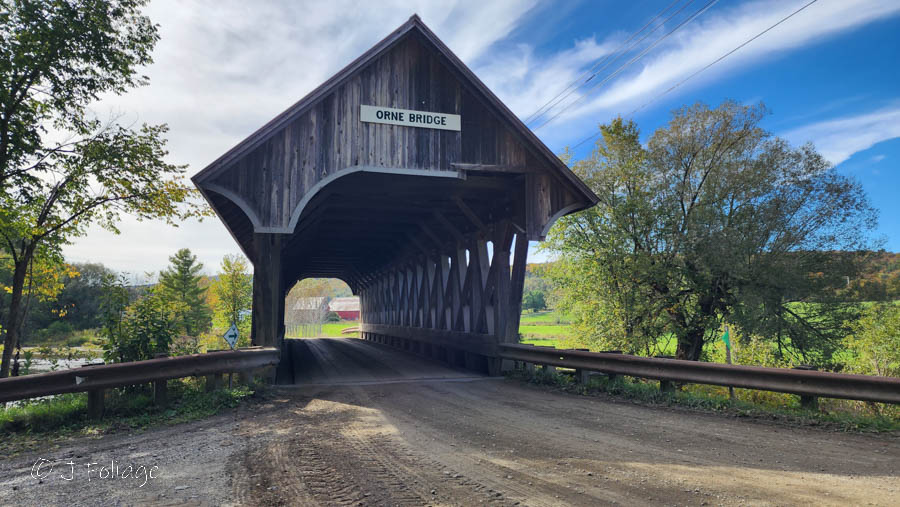
You’ll pass between some open fields and in a little over a half-mile, come to the Orne Covered Bridge. This one is a counter since it’s in all the covered bridge lists on the net. You also have a choice and it depends on how efficient you have been with your stops. You can continue across the bridge onto Back Country Road, meander down to the junction of Routes 14 and 58 and follow Route 58 East to Route 5 and Orleans. (Remember this is NOT the Mt Orne covered bridge which is over on the NH border, 55 miles away)
Basically, we’re heading to Orleans so you can head back up the way you just came in and jump back on Route 5, heading East to Orleans.
Orleans Vermont & Willoughby Falls
You have now arrived in the town of Orleans Vt. If you need gas or a bite to eat you can find a few places here. Of note* The Ethan Allen Furniture Company has one of its factories here, it’s a nondescript building on the main road, which is a large employer for the local population.
Willoughby Falls
At the far end of town there is St Theresa’s Church and on the opposite side of the road is left, Tarbox Hill Road. You will cross the Barton River and there is a small pull-off across the bridge. You can cross the road, down a set of steps, and along a path to the left and down. to view Willoughby Falls. Willoughby Falls is a small 15 ft drop and doesn’t show up in most books on waterfalls.
To actually see the falls you have to pass back under the bridge that is overhead and while there are good boulders to easily walk on it ceases to be a real walking path after you leave the stairs.
So you are on your own and need to know your capability as far as balance. If in doubt, you can forgo it because, while a nice hidden waterfall, it’s not worth falling down into the river.
Old Stone House Museum
Keep driving up Tarbox Hill Road which becomes Frog Pond Road. This is a beautiful drive that will take you to Hinman Settler Road. Turn left and drive a short distance to Old Stone House Road. Here you will find the Old Stone House Museum, and you are now in Brownington Vermont. There are volunteers who provide a tour of the house for a small fee, and the grounds and barns are open to the public, although donations are encouraged. You can easily spend an hour or two here if you really stop to experience the place.
From here you can return back to Route 58 the way you came, or explore some of these back roads. We’re going to retrace our steps back down to Route 58 turning left (east) and you will shortly come to Route 5A and turn right going south.
Lake Willoughby
You will arrive at the north end of Lake Willoughby. It is an amazing sight coming down the hill and the lake comes into view. If the lighting would be better from the other side, you can continue on 5A to the south end where there is a parking lot and access to a hiking trail up Pisgah (pronounced Pishga) We are told this is a bit of a strenuous hike and you should be prepared with good hiking shoes and be fit enough for this hike. We’ll just wait for you right here on the beach 🙂
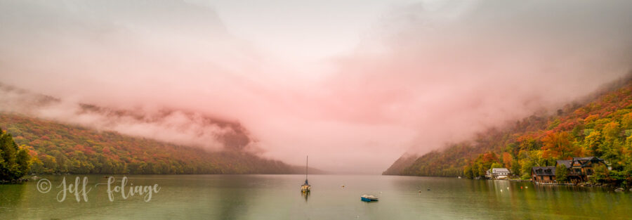
So, back at the north end of the lake, we will take Route 16 and we will start making our way back to Stowe. Barton is the next little town, and another lake, Crystal Lake. I don’t think you will meet Michael Meyers (you have to be a horror film buff to get that reference), but you will find some options for refreshments here. Lots of parking.
Continue on Route 16 going south through Glover. You can take a little side trip on Route 122 to the Bread and Puppet Theater, easily spending an hour or so there.
Clarks Pond
Back on Route 16 heading south towards Hardwick, you will find a small pond called, Clark’s Pond. Can’t fly the drone there but it can be very pretty.
Museum of Everyday Life
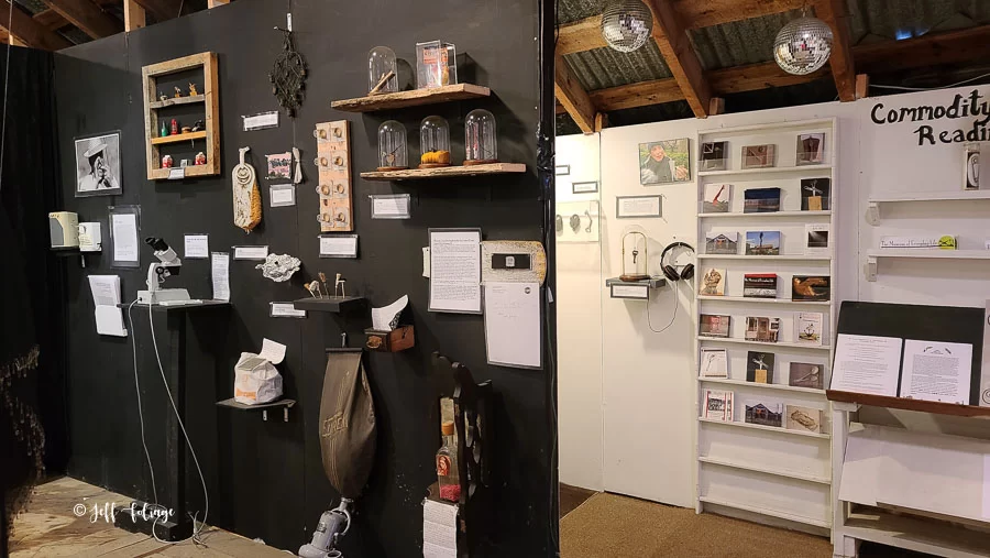
Right after Clarks Pond (literally on the bank of the pond) is the Museum of Everyday Life. We really did not know what to expect of this, housed in an old barn and our docent was a very friendly Rooster. the collection inside is a fantastic combination of everyday items, art, and rather bizarre things.
Returning back to Stowe
Then continue south on Route 16 and at the junction with Route 15, turn right heading into Hardwick. I am sure we missed many things we could have explored, but time is getting short. We have heard wonderful things about Positive Pies in Hardwick, but unfortunately, we weren’t there at mealtime so it will wait for another day. Keep going west on Route 15 and come back to where we started. Stay on 15 and then turn left on 100 to take you back to Stowe.
This loop route takes about 3 hours without any stops, so with the stops, it can take up most of the day. If you do any hikes, it will definitely be a full day. If you had the time, you could easily divert anywhere on this route and explore some of the back roads.
A bonus side trip is taking West Hill Road off of Route 14 (Just North of the junction with Route 15). We drove up West Hill Road to Simmons Road and then back down to Route 15 on Marsh Road to continue our journey on Route 15. It was a nice drive with lots of foliage, green pastures, and beautiful views.
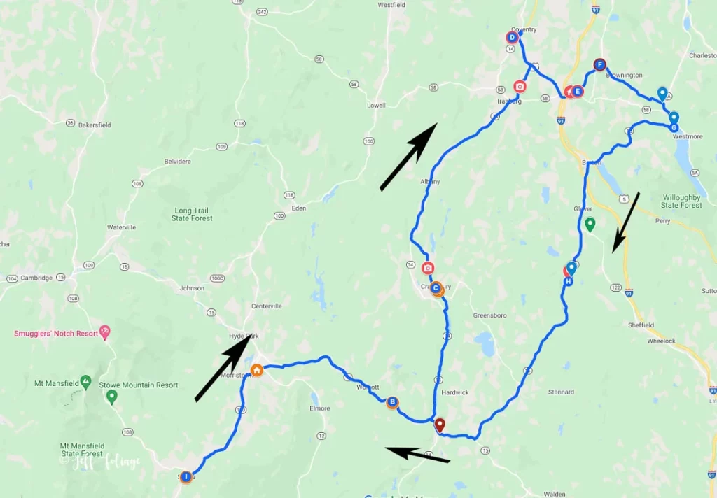
View Map of Today’s Route
Jeff Foliage Folger
Autumn is a state of mind more than a time of year – Jeff Foliage
- Visit my Fine Art America Gallery
- Visit my Amazon store to pick up New England-related materials
- Follow me on Bluesky
- My Facebook foliage page
- Threads.net/@Jeff_Foliage
- Follow our new Fall Foliage FB Group!
- You can visit Lisa’s Artist Facebook Page by clicking here

Great route overview Lisa… I’m going to do it later this week !
Thanks for all the good stuff you and Jeff do …I’ve been enjoying it now for several years.