The Mount Orne Vs. the Orne Covered Bridges
The biggest confusion factor is their names…
It is easy to locate “many” of the hundreds of covered bridges across New England. But when you are trying to catalog them all, it can get confusing. To start with, they were often named for a nearby feature or business. So the Blacksmith covered bridge was near the blacksmith. The Slaughterhouse covered bridge was near…, well, you can guess what it was near to.
There is also NO naming convention that prevents duplicates and across New England, it appears that several creameries were built near covered bridges. Also, Mill bridges are fairly common. Also depending on who you talked to, to get your directions from, (YES, in the olden days we didn’t have a handheld device to tell you where to go, you would stop and ask for directions!)
They might say cross over the Crystal Springs covered bridge but when you come to what you think is the correct covered bridge and a gentleman who is just coming through the bridge would say, “no, this is the Creamery bridge because as he knows this bridge carries you along the Creamery Bridge Road. (It also carries you above Crystal Springs Brook) It gets worse because this is listed on the maps as the West Hill covered bridge… AARGH!!!
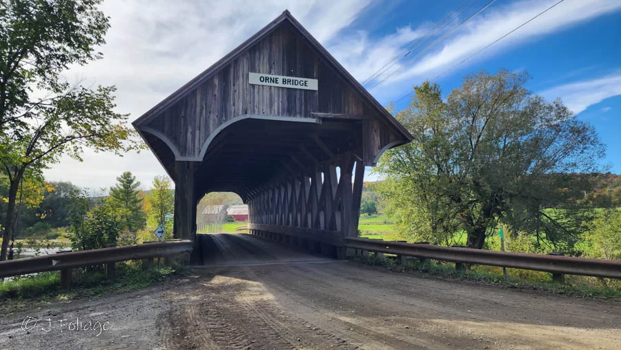
The Orne Covered Bridge and the Mount Orne Covered Bridge are two (different) covered bridges in Vermont that share a common name. Both bridges are located in rural areas, however, there are some key differences between the two bridges.
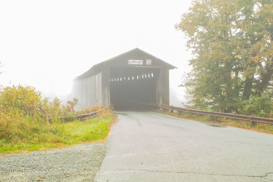
The Coventry-Orne Covered Bridge, Irasburg Vermont
The Orne CB (Covered Bridge) is located in Irasburg, Vermont, and is a replica of a historic bridge destroyed by arson in 1997. The bridge was rebuilt in 2000 and is a one-lane, Paddleford truss structure. It is 87 feet long and 17 feet wide. Click this link to look at a nearby “secret” covered bridge near the Orne CB.
Now let’s go 55 or so miles to the North West (check the map link above) and go to the…
Mount Orne Covered Bridge, Lunenburg Vermont & Lancaster New Hampshire
The Mount Orne Covered Bridge is located in both Lancaster New Hampshire and Lunenburg Vermont and crosses the Connecticut River. It was built in 1911. It is a Howe truss bridge that is 266 feet long and 20.5 feet wide. The bridge has two spans, one of 127 feet and one of 126 feet. (see the link above for a google map)
Mount Orne Vs. Coventry Orne Covered Bridges
These two covered bridges have led me on a wild goose chase for years. I never had a good grasp on which one I had captured in previous years. I have taken several photos from one side (no name but a road sign saying Mount Orne Road) and the other side that has a name (Lunenburg Vt) so I thought I had captured both the Orne AND the Mount Orne. I found out last year that there are about 55 miles between the Coventry-Orne Covered Bridge and the Mount Orne Covered Bridge. I found I did NOT have the Coventry-Orne covered bridge, so last fall I made it a point to go find it and finally put this to rest.
The Mount Orne Covered Bridgedge was built in 1911 and is one of the oldest covered bridges in Vermont. The bridge was originally built to connect the two towns of Lancaster and Lunenburg.
The Orne Covered Bridge is a popular spot for tourists and locals alike. It is a beautiful example of a covered bridge, and it is a great place to take a walk or go for a picnic. The Mount Orne Covered Bridge is also a popular spot, but it is not as well-known as the Orne Covered Bridge. It is a great place to take a walk or go for a bike ride.
It takes foreknowledge of the area to capture both in a day The two bridges are NOT connected by a scenic road that passes through rural farmland and forests even though several AI products seem to say they do. Yes, parts of this article were created using ChatAI and BardAI but as with all these products, you really have to go there and see them for yourself to write about them.
View this Fall foliage primer on the fall colors.
You’re Always a short Detour from
Take a look at the map on their website and pick a start and end point. simply click on places along your route to add them to your itinerary.
There are tons of places that are listed from diners to B&Bs and activities to explore.
Save $5 off the year’s cost
Many people will say that they can do the same thing for free in Google Maps and this is true. But this is SO MUCH SIMPLER…
I’ve looked at it and find it to be of value to my readers. As a further bonus, if you sign up for their service, you can use this code BTR5QTP and take $5 off the one-year price.
This can be used anywhere in the U.S. and I think you will find it super simple to use. You can make a map with 5 waypoints for free so try it and see! Click here to try it out.
Jeff Foliage Folger
Autumn is a state of mind more than a time of year – Jeff Foliage
- Visit my Fine Art America Gallery
- Visit my Amazon store to pick up New England-related materials
- Follow me on Bluesky
- My Facebook foliage page
- Threads.net/@Jeff_Foliage
- Follow our new Fall Foliage FB Group!
- You can visit Lisa’s Artist Facebook Page by clicking here


Comments
The Mount Orne Vs. the Orne Covered Bridges — No Comments
HTML tags allowed in your comment: <a href="" title=""> <abbr title=""> <acronym title=""> <b> <blockquote cite=""> <cite> <code> <del datetime=""> <em> <i> <q cite=""> <s> <strike> <strong>