Exploring the Picturesque Heights: A Guide to the Scenic Views of the Pioneer Valley of Massachusetts
Nestled in the heart of New England, the Pioneer Valley of Massachusetts boasts an array of breathtaking landscapes, charming towns, and historic landmarks. However, the rolling hills and expansive vistas truly steal the show, offering visitors and locals an opportunity to immerse themselves in the region’s natural beauty. In this guide, we’ll journey through some of the most captivating high hills in the Pioneer Valley, each offering its unique perspective and scenic allure.
Poets Tower in Greenfield Massachusetts
Today we’ll start at the northern end of the Pioneer Valley between Turners Falls and Greenfield Massachusetts. The Connecticut River will be our guide through the valley and as it winds it’s way past many (high Hills) Mountains. The elevations of the following “mountains” are between 600 to 1,100 ft so if 4,000+ footers are your desire head north to New Hampshire and Vermont.
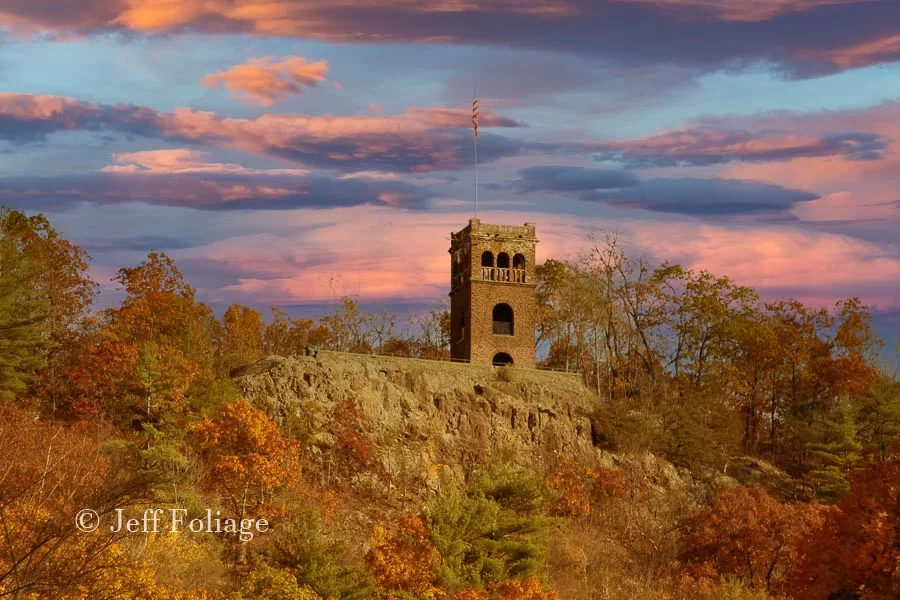
We’re going to start with a low unpresuming narrow ridgeline that separates Greenfield Massachusetts from the Connecticut River. To the north of the ridgeline is the town of Montague and Turners Falls. Now, in order to see both Montague and Greenfield at the same time you can either hike up from Greenfield or drive up (there is limited parking). You see, on top of this low ridgeline (200′-250′) is a stone tower that you can climb another 130′ to get these views.
Here are links to a few of the trails, one loop is 2.4 miles. You can find more about it at the All Trails website. There is a small parking lot below where you can park and the “hike”/walk up is .4 miles, and is rated as easy. Read about it here on the Mohawktrail.com website. You will also get some history about it as well.

Now we’re heading south on Route 5 for about 8 miles. Our next stop is Mount Sugarloaf and Sunderland Massachusetts. Want to get out and stretch your legs? Here is a book by a photographer friend of mine (John Burk) and he details all of these “Mountains” and their hikes.
His books are a great source of information and he has published many books related to Massachusetts.
Mount Sugarloaf
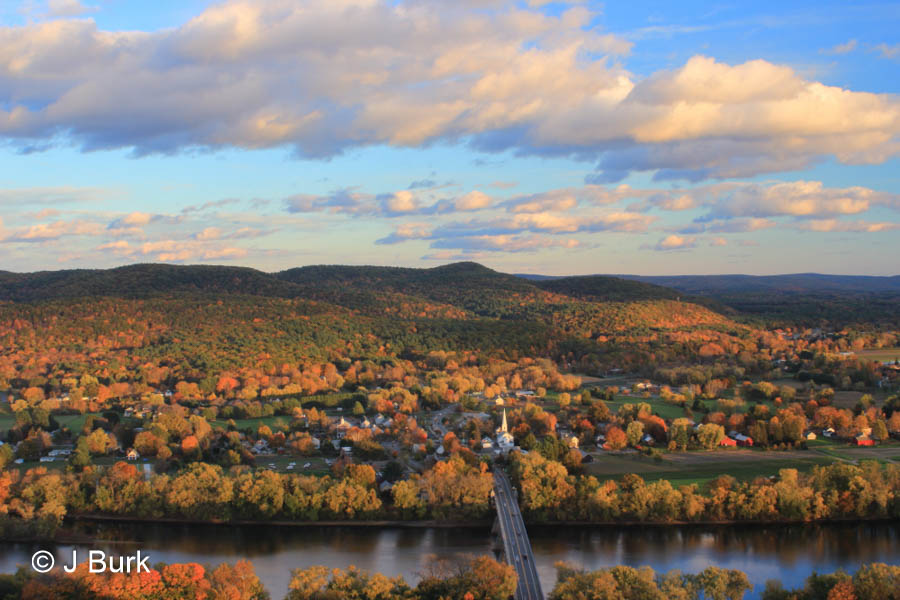
A beloved destination for outdoor enthusiasts, Mount Sugarloaf offers a more accessible yet equally captivating vantage point. Rising abruptly from the valley floor, this basaltic butte provides sweeping views of the surrounding countryside. Below is a view of the Connecticut River as seen from Sugarloaf Mountain by John Burk, link to his gallery on Fine Art America.
For hiking, any of these trails, visit my Amazon page for hiking gear… Based on photographs I’ve seen, below is a “creative” AI image of a view from Mount Sugarloaf. It’s not quite the same, is it?
Take the leisurely hike to the summit or opt for a scenic drive along the winding road that leads to the parking area near the top (VERY limited parking). From there, a short stroll brings you to the lookout point where you can marvel at the meandering course of the Connecticut River below and the picturesque towns dotting its banks. Mount Sugarloaf is a popular spot for picnics, photography, and simply basking in the beauty of nature.
Mount Holyoke & Skinner State Park on One Ridgeline
Just across the Connecticut River from Mount Tom, you will find tucked away in the northern reaches of the Pioneer Valley, Mount Holyoke, and Skinner State Park Reservation. The rugged beauty of Mount Holyoke, Mount Skinner, and its surrounding woodlands run a knife-like ridge line that runs to the east.
Mount Holyoke is an iconic landmark in the Pioneer Valley, rising majestically above the Connecticut River. Its summit, crowned by the historic Summit House, offers panoramic views stretching across the valley and beyond. The primary method to ascend the mountain is via the many trails that give you access to the top of the Mountain. Access to Mount Holyoke and Skinner State Park or the Mount Holyoke Rage State Park is by the many Hiking trails that wind through pristine forests and rocky terrain, eventually ascending to the summits.
They both have either easy and/or challenging trails that pass through lush forests and rocky outcrops which lead you to panoramic vistas. Once at the top, you can catch your breath as you gaze upon the patchwork of farmland, meandering waterways, and distant mountains that define the valley’s landscape. Mount Holyoke’s vistas are particularly stunning during the fall foliage season when the hillsides ignite with vibrant hues of red, orange, and gold.
Mount Tom
Dominating the skyline on the eastern edge of the valley, Mount Tom offers an expansive playground for outdoor adventures. Whether hiking, mountain biking, or simply driving to the summit, visitors are rewarded with stunning views that extend from the Berkshires to the rolling hills of central Massachusetts. We exited Route 5 onto Reservation Road. If you want the highest point, you will take Reservation Rd to Christopher Clark Rd Turning right onto a small road that runs the western flank of Mount Tom. At the parking lot, you will walk the Eyrie House Ruins Trail to one of the highest points on Mount Tom. Lisa and I decided to skip this and instead bagged the view from Bray Tower.
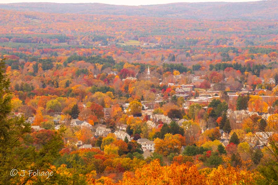
There are many pull-offs from which to explore the different areas of Mount Tom. I would do one of the trails to the higher elevations because the roadside view is sometimes obscured by trees and brush. So getting a clear view is sometimes difficult. This means climbing one of the towers for a scenic view.
The Mount Tom State Reservation encompasses diverse ecosystems, from dense forests to open meadows, providing ample opportunities for exploration. As you stand atop the mountain, with the wind in your hair and the valley spread out below, it’s easy to feel a profound sense of connection to the natural world.
Conclusion
The Pioneer Valley of Massachusetts is a treasure trove of natural wonders, with its high hills offering some of the most spectacular views in the region. Whether you’re a seasoned hiker seeking a challenge or a casual visitor looking for a scenic drive, these elevated vantage points provide an opportunity to immerse yourself in the beauty of the landscape. So pack your camera, lace up your hiking boots, and prepare to be awe-struck by the panoramic vistas awaiting you in the Pioneer Valley
Links to maps of the Pioneer Valley
- https://www.google.com/maps/place/300+Sugarloaf+St,+South+Deerfield,+MA+01373/@42.4705753,-72.593903,15.75z/data=!4m5!3m4!1s0x89e12cbefda7a023:0x49136dfb1fd24a66!8m2!3d42.4672945!4d-72.5947149
- https://www.google.com/maps/place/Skinner+State+Park/@42.3441538,-72.6140504,11.49z/data=!4m12!1m6!3m5!1s0x0:0xa8835a506366bc5e!2sMount+Holyoke+Range+State+Park!8m2!3d42.3054936!4d-72.5276784!3m4!1s0x89e6d0868687e9ef:0xad38f3986117c662!8m2!3d42.300504!4d-72.5876945!5m1!1e4
- https://www.mass.gov/locations/mount-tom-state-reservation
- https://www.google.com/maps/@42.4727347,-72.6916378,12.25z/data=!5m1!1e4
- https://www.google.com/maps/search/ount+holyoke+ma/@42.2706184,-72.6182484,13z
Jeff Foliage Folger
Autumn is a state of mind more than a time of year – Jeff Foliage
- Visit my Fine Art America Gallery
- Visit my Amazon store to pick up New England-related materials
- Follow me on Bluesky
- My Facebook foliage page
- Threads.net/@Jeff_Foliage
- Follow our new Fall Foliage FB Group!
- You can visit Lisa’s Artist Facebook Page by clicking here


Comments
Exploring the Picturesque Heights: A Guide to the Scenic Views of the Pioneer Valley of Massachusetts — No Comments
HTML tags allowed in your comment: <a href="" title=""> <abbr title=""> <acronym title=""> <b> <blockquote cite=""> <cite> <code> <del datetime=""> <em> <i> <q cite=""> <s> <strike> <strong>