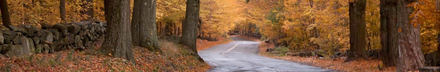
Hidden in Plain Sight: 5+ New Hampshire Covered Bridges in One Afternoon
There are many clusters of covered bridges, some I’ve written about, like the Montgomery covered bridges and Northfield 5 in Northfield Falls, Vermont. If you’re like me, you want to spend less time behind the wheel and more time behind the lens. That’s the magic of a ‘bridge cluster’—you get maximum autumn atmosphere with minimum mileage.
Covered bridge clusters I’ve written about are:
Today, I’m going to introduce a new group. Down in Southern New Hampshire, there are five covered bridges that you can easily cover in a day (probably less).
The Swanzey Cluster of Covered Bridges, all within 6 miles +/-
Just south of the picturesque town of Keene, New Hampshire (worth a visit on its own), you will find Swanzey NH. Swanzey is broken up into North, East, and West Swanzey. There are also two roads leaving Keene (Routes 10 and 32) that lead to the covered bridges in question, and the bridges are:
- Sawyers Crossing/ Cresson Covered Bridge
- Carlton Covered Bridge
- Thompson Covered Bridge
- Slate Covered Bridge
- Coombs Covered Bridge
- (a Bonus covered Bridge)
The routes to cover these bridges are Routes 10 and 32, and covers only about 5-6 miles. There is no perfect route to hit all of them smoothly, so I would say look in the NHVT Gazetteer on page 81, and you can spot 4 of the 5 above-mentioned covered bridges. The Combs covered bridge has been left off, but more on that later. Let’s start out on Route 10 south from Keene (also known as the W. Swanzey Road) for about 1.87 miles and make a left onto Ash Hill Rd. (traveling another 1.4 miles) You will arrive at…
The Sawyers Crossing (Cresson): The Perfect Starting Point
As you approach the red covered bridge, you will see a big parking area on the left. (park the car). The bridge carries Sawyers Crossing Rd over the Ashuelot River.
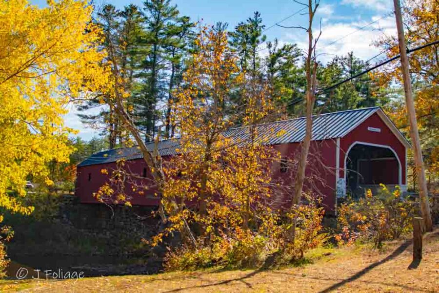
Outside of the shots of the open ends, the only other “interesting” shot is this one through the trees. Maybe you can find an intriguing vantage point… I didn’t have a drone back when I photographed this in 2020. Next, I would leave the Cresson bridge by going through and following Sawyer’s Crossing Rd to the South. Pick up Route 32 South until you see Carlton Rd on the left.
The Carlton: A Quiet Escape
As you approach the Carlton covered bridge, you will see a small (1-2 cars), but if somebody is on your bumper and you can’t stop for this one, don’t fret. There is another pull-out on the other side.
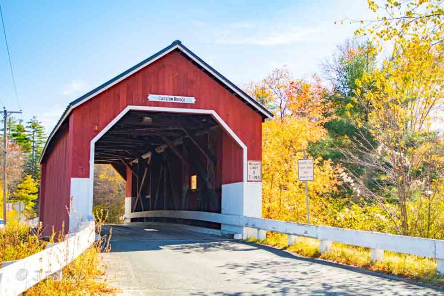
Another red-covered bridge, the Carlton, can be photographed from either end, and during the fall, you can capture some nice fall colors in mid-October. The Carlton Covered Bridge spans a small, unnamed tributary within the Ashuelot River watershed, tucked into the rural landscape of southwestern New Hampshire.
From here, it’s up to you which way you continue. You can head south and west, back to Route 10, or North. I’m going to say to head back North, pick your own route, butmake sure you end up at the Thompson covered bridge. Check this Google map link or pick a few Routes in your Gazetteer.IF you don’t have your Delorme Gazetteer, then head over to my Amazon affiliate store.
Historic red Thompson Covered Bridge
Ok, if you are following any of my directions, you are now back over in West Swanzey. The Thompson is another red covered bridge that spans the Ashuelot River and takes Main St over the river. There is a large parking area on either side of the covered bridge. While the power lines make a classic wide shot difficult, look for the ‘micro-stories’—the weathered textures of the boards and the way the 19th-century craftsmanship holds its ground against modern life.
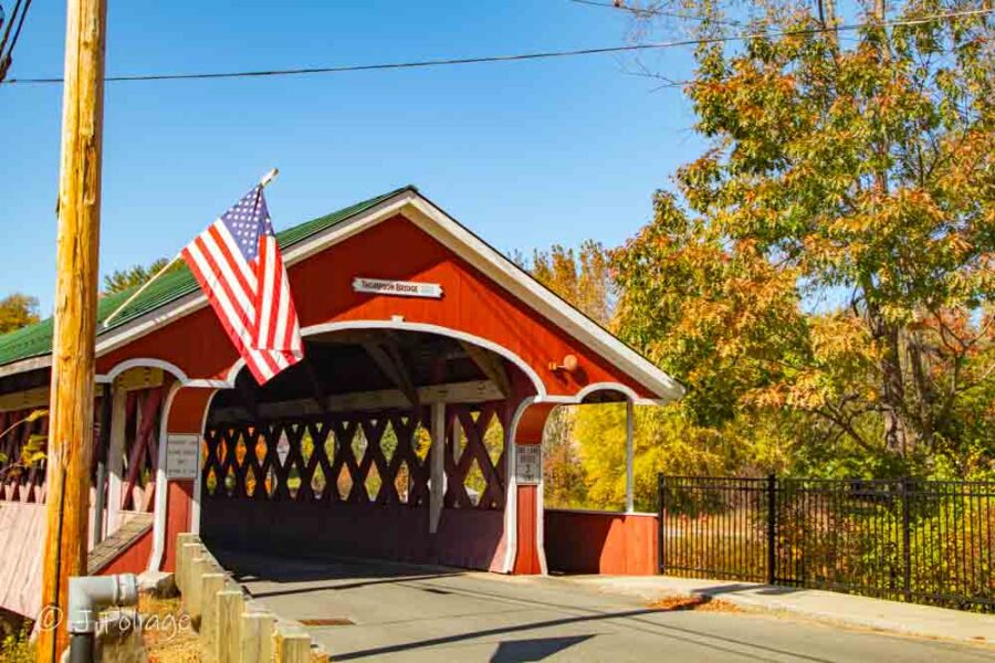
Constructed in the 19th century, the Thompson Covered Bridge is one of New Hampshire’s enduring links to an era when craftsmanship favored strength, simplicity, and permanence. Its weathered boards and classic proportions speak softly of daily crossings, changing seasons, and a community shaped by the river it spans.
You again have options for getting to our next covered bridge, head east and catch the Holbrook Ave south and approach the Slate CB from the East or jusp back on Route 10 and then look for the left turn onto the Westport Village Rd, which leads you directly to the Slate CB.
The Slate Covered Bridge
The Slate CB was rebuilt after a fire in 1993 destroyed the original. This one (another RED covered bridge) that once again spans the Ashuelot River and carries the Westport Village Rd over the river.
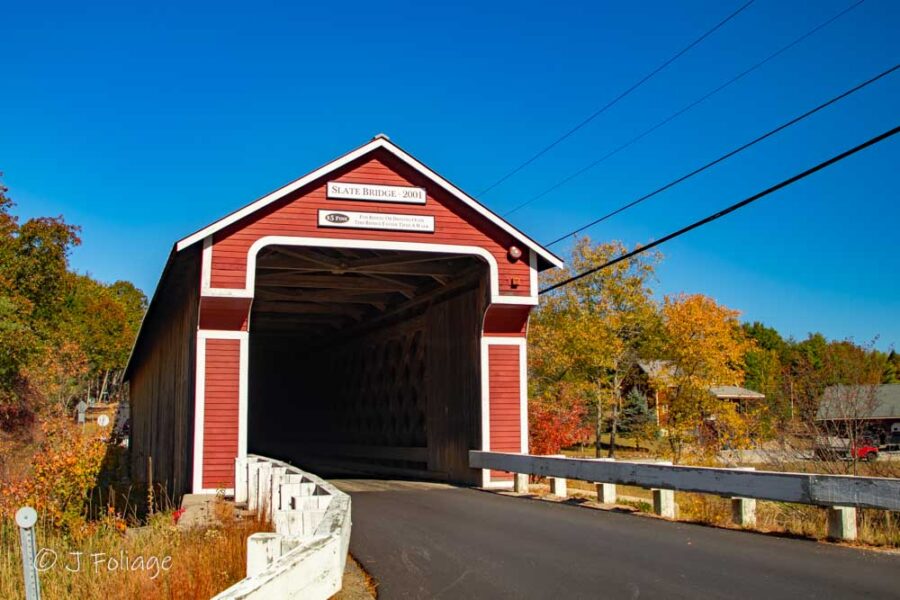
The planners also made this one much taller for today’s bigger 18-wheelers and the like. What I miss about the old one was the stories, likea gentleman being held up by highwaymen, and if you would like to read about a couple of those stories, here is a link to a website that gives a few details.
The Combs: The One the Map Forgot
When you leave the Slate CB, head left on Route 10. and watch on the right. I believe it’s not much more than a quarter mile, and there “may” be a sign saying Combs Covered Bridge, but this bridge is not listed in the Delorme Gazetteer. Lisa and I were doing these bridges in mid-October (11th) of 2020, and I passed this road and said we missed a covered bridge, so I pulled over and Lisa double checked the Gazetteer. She looked up and said, “No, no covered bridge”…
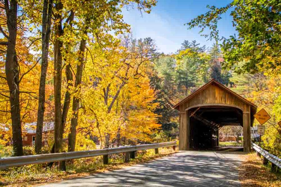
We had a let’s call it a “discussion,” and because she did not see the sign, I said I was right, no matter what the Gazetteer did or did not say. I turned onto the road, and a short distance down was the covered bridge. So, the Combs Bridge takes Combs Bridge Road over the Ashuelot River (once again), but this is not a red-covered bridge. The first one today, but not the last one…
📷 Pro-Tip: If you’re chasing the light, start at Sawyers Crossing in the early morning and work your way south. Most of these bridges sit over the Ashuelot River, providing beautiful reflections when the water is still.
Bonus Covered Bridge
You would think that with all these covered bridges carrying various roads over the Ashuelot River, there would be an Ashuelot Covered Bridge…
The Ashuelot Covered Bridge
Well, you would be right. From the Combs covered bridge, you will go back out to Route 10 and head South to Winchester until you see Hinsdale Rd (Route 119) on the right, and follow this until you come to Ashuelot, New Hampshire, and the Ashuelot covered bridge. (approximately 7.6 miles)
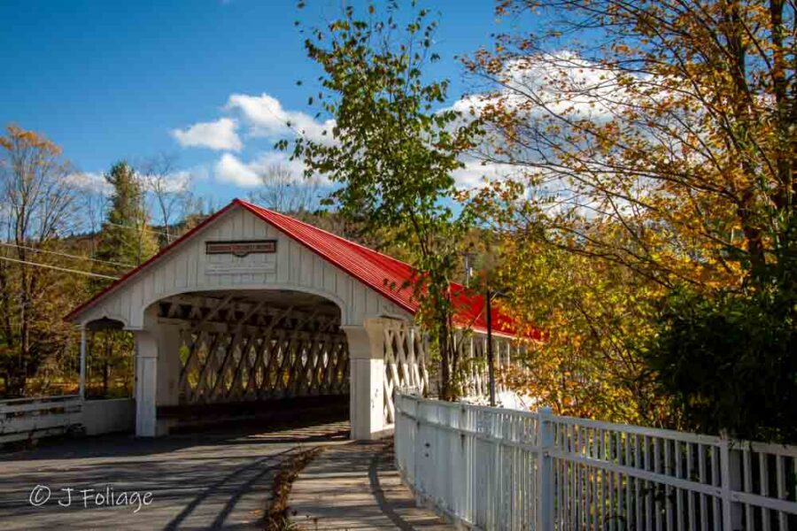
In this covered bridge, which is white (but it does have a red roof!), the Alan Hill Rd is carried over… You guessed it, the Ashuelot River! The Ashuelot Covered Bridge is an Elegant Outlier in contrast to all the earlier red covered bridges. It has open lattice work on both sides of the bridge and is one of the prettier covered bridges that I have photographed (even if it’s not red…)
Just down the road is Rindge, New Hampshire, and the Cathedral in the Pines, and if interested, here is the link to that article.
Jeff Foliage Folger
Autumn is a state of mind more than a time of year – Jeff Foliage
So happy to see that you are visiting and photographing New Hampshire’s covered bridges. This is a wonderful day trip in the Monadnock Region! Thank you for sharing!
Thanks Kim, I love the NH covered bridges but always seem to write about the Vermont ones… Do you have a fav NH covered bridge?